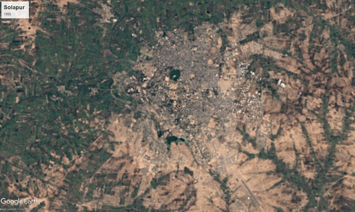
Solapur
14,895 sq. km
~46.61 lakh (2019)
978 (2011)
~ ₹69,943 crore (2019)
~ ₹1.51 lakh (2019)
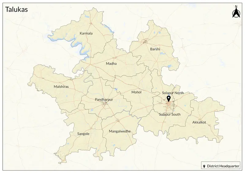
Solapur is situated on the Deccan Plateau, sharing borders with Ahilyanagar, Dharashiv, Sangli, Satara, and Pune, as well as Kalaburagi and Vijayapura districts in Karnataka. It's a vibrant hub linking Maharashtra to Karnataka and Andhra Pradesh. The name Solapur was traditionally believed to come from ‘sola’ (sixteen) and ‘pur’ (village), referring to a cluster of sixteen villages (historically, the district included sixteen villages, such as Aadilpur, Ahmedpur, Chapaldev, Fatehpur, Jamdarwadi, Kalajapur, Kadarpur, Khandervkiwadi, Muhammadpur, Ranapur, Sandalpur, Shaikpur, Solapur, Sonalagi, Sonapur, and Vaidakwadi). Some historical inscriptions also suggest that the name evolved from ‘Sonnalage’ to ‘Sonnalagi,’ later becoming Sonalipur, Sonalpur, and Sandalpur.
Solapur’s ancient lineage traces back to Asmaka in the north and Manadesha in the south, seeing rule by the Mauryas, Satavahanas, Chalukyas, Rashtrakutas, Yadavas, and Bahamanis. In the medieval and colonial era, it was governed by the Delhi Sultanate, Bahmani and Nizam Shahi sultanates, and the British. The district was officially established in the mid-19th century and became part of Maharashtra in 1960.
Solapur has several important religious and cultural landmarks. The Siddheshwar Mandir, located in Solapur city (home to the famous “Gadda Yatra” fair), is built on a large water tank, giving it the appearance of an island. In Barshi, the Bhagwant Mandir, built in 1245 CE, is the only Mandir in India where Vishnu Dev is referred to as 'Bhagwant'. The Kamala Bhavani Mandir in Karmala, constructed in 1727 by Rao Raje Nimbalkar, is considered the second seat of Tulja Bhavani after Tuljapur in Dharashiv. Solapur has produced notable artists, filmmakers, and scholars. Its struggles against the British—particularly the flag hoisting on the municipal building in 1930—earned it the title “City of Hutatmas (Martyrs).” Numerous temples, dargahs, and a vibrant handloom artisan tradition infuse its urban and rural stretches.
Solapur sits entirely within the river basins of the Bhima and Seena, and its terrain ranges from black cotton soil plains to arid stretches reliant on major dams like Ujjani. The district experiences a semi-arid climate, with dry farming as a staple except in irrigated patches. Its location at the crossroads of rail and highway routes has made it a logistics and transport hub linking multiple Indian regions.
The district is a major center for small- and medium-scale industries, particularly in textiles, with a strong handloom, powerloom, and cotton mill sector. It is renowned particularly for the handloom “chadar” and towel, which have earned the Geographical Indication (GI) tag. The district also leads in beedi (Indian cigarette) production, oilseeds, and pomegranate cultivation, with jowar, wheat, and sugarcane as the primary crops. It is also the home to major sugar factories. Solapur’s markets are important for grain, cotton, and livestock, and the city’s medical, engineering, and educational colleges attract students and patients from nearby states. Industry is centered on MIDC zones and a growing mix of engineering and agri-based enterprises.
Explore Solapur