Contents
- History
- Ancient Trade Routes
- Tanga Carts
- Hath Gadi
- Modes of Transportation in the District
- Rail Transport
- Overview of Bus Networks
- Autos & Shared Vehicles
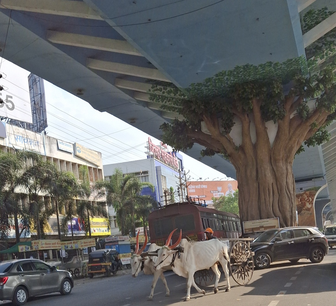
- Bullock Carts
- Air Travel
- Ferries & Water Transport
- Traffic Map
- Communication Networks
- Newspapers & Magazines
- What’s on the Billboards? A Look at Ahilyanagar’s Hoardings
- Graphs
- Road Safety and Violations
- A. Cases of Road Safety Violations
- B. Fines Collected from Road Safety Violations
- C. Vehicles involved in Road Accidents
- D. Age Groups of People Involved in Road Accidents
- E. Reported Road Accidents
- F. Type of Road Accidents
- G. Reported Injuries and Fatalities due to Road Accidents
- H. Injuries and Deaths by Type of Road
- I. Reported Road Accidents by Month
- J. Injuries and Deaths from Road Accidents (Time of Day)
- Transport Infrastructure
- A. Household Access to Transportation Assets
- B. Length of Roads
- C. Material of Roads
- D. Licenses Issued
- Bus Transport
- A. Number of Buses
- B. Number of Bus Routes
- C. Length of Bus Routes
- D. Average Length of Bus Routes
- E. Daily Average Number of Passengers on Buses
- F. Revenue from Transportation
- G. Average Earnings per Passenger
- Communication and Media
- A. Household Access to Communication Assets
- B. Newspaper and Magazines Published
- C. Composition of Publication Frequencies
- Sources
AHILYANAGAR
Transport & Communication
Last updated on 6 November 2025. Help us improve the information on this page by clicking on suggest edits or writing to us.
Ahilyanagar district serves as a significant yatra center, attracting approximately more than 15 to 20 lakh visitors annually. As a result, many infrastructure developments have been undertaken to accommodate both local and external transportation needs. The district is connected by rail, bus, auto-rickshaw, and air travel, with the availability and reach of these systems offering a glimpse into its evolving transport landscape.
History
Ancient Trade Routes
In earlier times, many trade centers existed across the Deccan region, and Paithan was one of the most prominent. It is suggested in the colonial district Gazetteer (1884) that “Paithan [being] on the eastern border of Ahmadnagar [now Ahilyanagar] was one of the chief centres of trade in the Deccan, traffic must have crossed the Ahmadnagar district over the Sahyadri hill to the coast.” During this period, transportation likely relied heavily on horses and other pack animals.
Tanga Carts
As trade and movement increased, various modes of transport emerged, and among them, the Tanga (horse-drawn carriage) was widely used in many parts of India. However, over time, its presence has faded. In Ahilyanagar, locals say that Tanga carts were a common sight until about four decades ago. Each cart could carry five to six passengers, and water tanks (haud) were placed at key locations, such as Navi Peth and the Ahmednagar bus stand, to provide resting points for the horses. A designated parking area, known as Tanga Galli, accommodated these carts. With the growing popularity of auto-rickshaws, however, the use of Tanga carts has declined significantly.
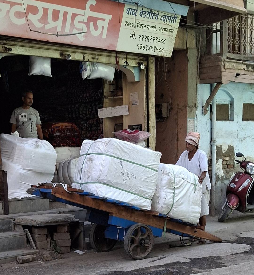
Hath Gadi
As transportation methods evolved, they were developed not only for moving people but also for transporting goods. One traditional method that remains in the district for this purpose is the Hath Gadi or wooden hand cart, which is manually pulled by a person.
These carts are primarily used for carrying larger parcels, such as clothing and bedding, and are frequently seen in the Kapad Bazar area of the city.
Modes of Transportation in the District
Rail Transport
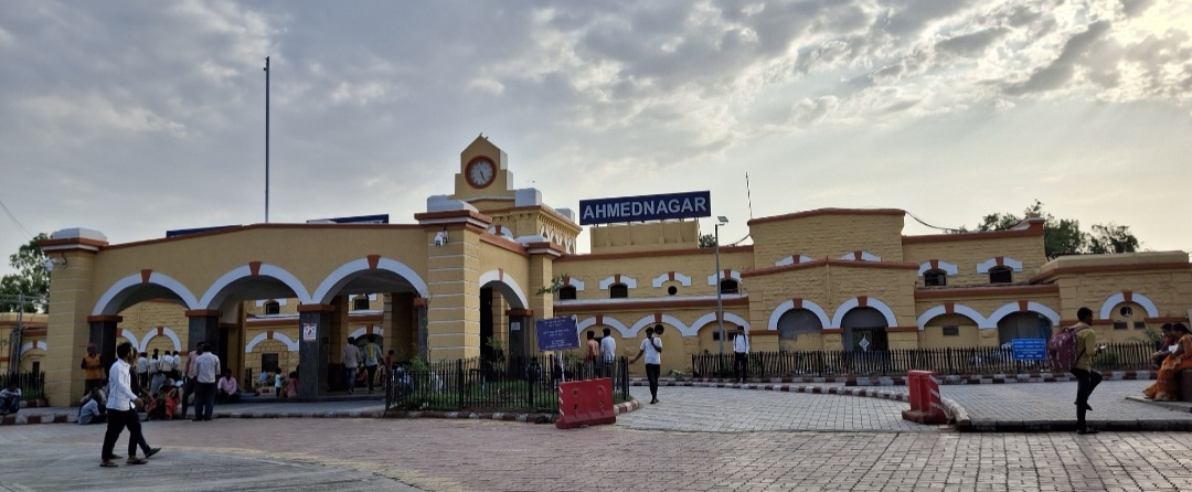
Ahilyanagar district is served by a well-established railway network that facilitates both passenger and freight transportation. The district falls under the Central Railway zone, with two main railway lines passing through it - the Daund–Manmad line and the Ahmednagar–Beed–Parli Vaijnath line. According to the RailYatri website, the district has 10 railway stations of which Ahmednagar Railway Station (ANG) and Shirdi Station are its busiest hubs. Both stations are part of the Pune railway division.
The railway transport in the district has a long and interesting history. The origins of railway infrastructure in the district date to the British colonial period. While the Great Indian Peninsula Railway did not develop local infrastructure in Ahilyanagar to the same extent as in Mumbai or Pune, the establishment of the Daund-Manmad line in the late 19th century contributed significantly to the establishment of a railway network within the district.
The Daund and Manmad railway line was surveyed in 1868 and refined in 1876, responding to the region’s expanding trade requirements. Construction commenced in 1877, strategically employing local labor during famine relief efforts. The project involved constructing substantial masonry bridges over major rivers including the Bhima and Godavari. The line was officially inaugurated on 17 April, 1878, marking a pivotal moment in the district’s transportation history. This infrastructure development created a crucial transportation corridor connecting various railway segments and has only expanded over the years.
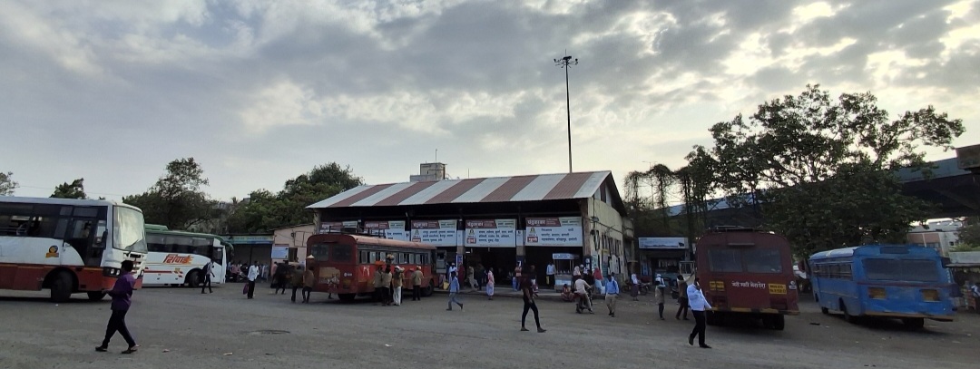
Overview of Bus Networks
When it comes to intra-district and inter-district travel, buses are a preferred mode of transport for many in the district. This transportation system comprises both public and private service providers, with the Maharashtra State Road Transport Corporation (MSRTC) being the most preferred operator. The Pune Bus Stand functions as a central hub, facilitating travel connections between districts and various talukas in the region.
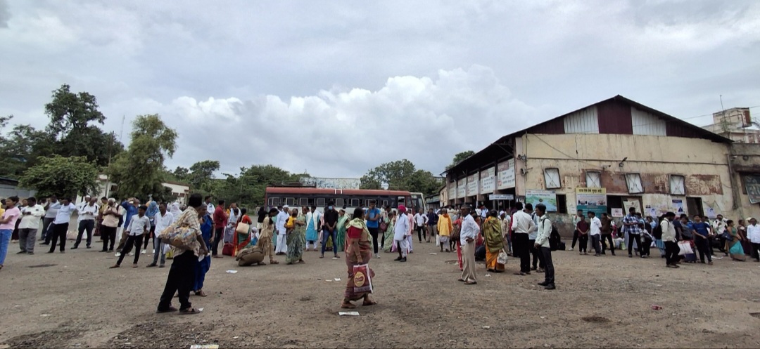
In many cities with a Municipal Corporation, City Bus services facilitate intra-city travel. In Ahilyanagar, a distinctive approach to urban public transportation has been implemented through a public-private partnership. Unlike traditional municipal bus services, the Municipal Corporation has contracted ‘Purple Buses’ to operate throughout the City.
However, residents have raised concerns about the system, citing a lack of organization. Many passengers wait by the roadside to board buses, as bus stands are either insufficient or poorly maintained. Additionally, ticket counters have been criticized for their disorganized state. These challenges highlight the need for improvements to enhance the efficiency and accessibility of Ahilyanagar’s bus network.
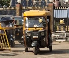
Autos & Shared Vehicles
Auto rickshaws, which are three-wheeled vehicles, have become the dominant form of local transportation in Ahilyanagar. The transportation ecosystem is entirely privately operated, with rickshaw drivers typically setting their own fares. Standard auto rickshaw fares range from ₹100 to ₹125 for distances of 2-4 km, with passengers often needing to negotiate prices.
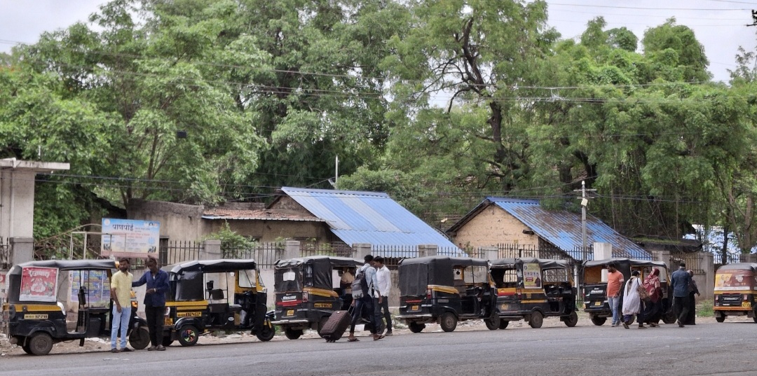
Recently, six-seater rickshaws known as ‘Tam-Tams’ have been introduced. These can accommodate seven to eight passengers and charge between ₹10 to ₹25 per person, making them a more affordable option for larger groups.
However, the fare for six-seater rickshaws varies between talukas. In some areas, locals report that Tam-Tam rickshaw fares can range from ₹40 to ₹50.
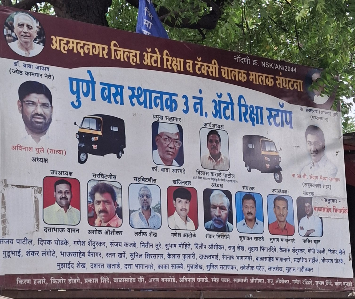
The fare structure and auto-rickshaw services in the district, notably, operate within an organized framework. The Ahmednagar Jilha Auto Rickshaw and Taxi Chalak Malak Sangathana is a local organization that represents auto-rickshaw and taxi drivers. It is responsible for negotiating fare structures, establishing service guidelines, and ensuring compliance with regulations.
Bullock Carts
Bullock carts continue to serve as a mode of transport for some in the Ahilyanagar district. In the surrounding rural areas, they remain a traditional means of transporting goods, particularly among farmers and villagers. As the name suggests, this mode of transportation relies on bullocks to pull two-wheeled wooden carts carrying goods or passengers.
Air Travel
The district is also accessible by air through Shirdi Airport, located in Kakdi, Kopargaon. Operational since 1 October 2017, the airport serves the Shirdi region, offering air connectivity for pilgrims and travelers. Covering an area of 350 hectares, it was developed under the Government of India’s Greenfield Airports Policy.

The airport connects Shirdi to major metropolitan cities, reducing travel time for visitors to the Sai Baba Samadhi Mandir. Before its establishment, travelers typically used airports in Mumbai, Pune, or Chhatrapati Sambhaji Nagar and then traveled by road to Shirdi.
Ferries & Water Transport
Water transport is no longer a common mode of daily travel in the region. The district, lying in a semi-arid area, experiences dry conditions for much of the year, and locals note that the Sina River, which runs through the city, often remains dry.
Historically, however, water transport played a crucial role in regional trade and travel. As noted in the district colonial Gazetteer (1884), during the colonial period, eleven local ferries operated from June to October, connecting communities along major rivers such as the Bhima, Godavari, Pravara, and Mula. These ferries were vital for transporting people and goods across the district.
While water transport has largely faded, Bhandardara in Akole taluka, which is one of the few areas in the district that receives significant rainfall, still has private boats, though many are aging. Still, interestingly, water transport continues to be used here, albeit in a different context today. Rather than daily travel, it is used here for recreational and adventure activities.
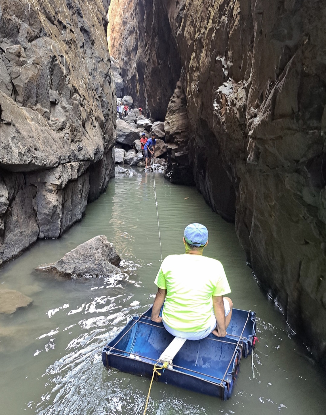
In Sandhan Valley, a well-known trekking destination in Bhandardara, trekkers rely on a makeshift watercraft to navigate water crossings. This vessel is created by cutting a water drum in half and reinforcing it with a wooden or iron bar for seating and stability. Tethered with ropes at both ends, it is pulled across the water by a person on land. This practical solution allows trekkers to safely traverse the valley’s water bodies.
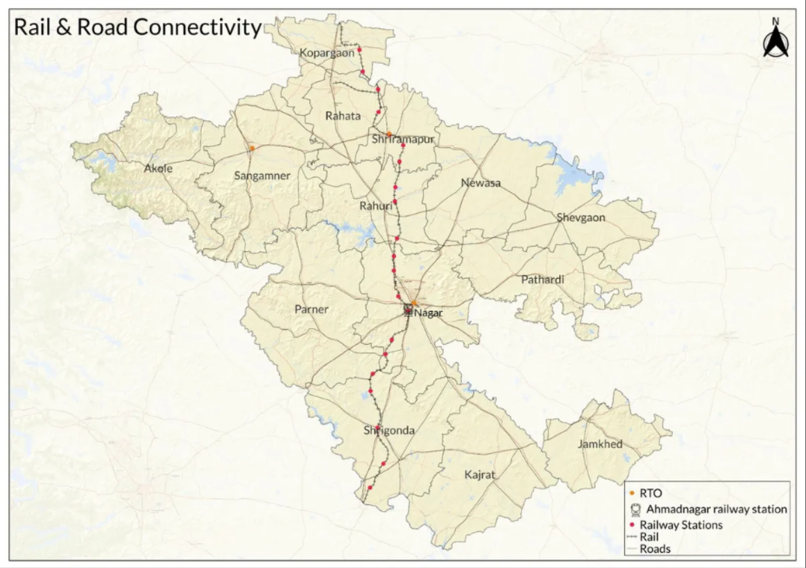
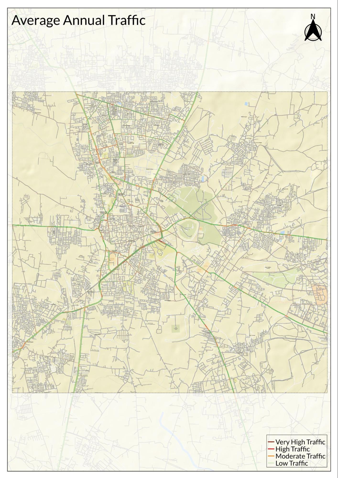
Traffic Map
Communication Networks
Newspapers & Magazines
In the 1880s, the district was known for its local Marathi newspaper publications. According to the district Gazetteer (1884), three Marathi newspapers were printed in Ahilyanagar. Nyayasindhu, also known as Ocean of Justice, was a lithographed weekly newspaper that had been in circulation for 18 years. Lithography, a printing technique that involves transferring an image from a flat stone or metal plate onto paper, was used in its production. Nagar Samachar, or Nagar News, had been published for about ten years, while Jagaddarsh, or Mirror of the World, was in circulation for two years.
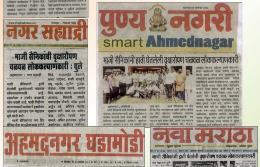
Today, the district has a diverse range of Marathi newspapers, including Divya Marathi, Sakal, Lokmat, Hello Ahmednagar, Nava Maratha, Pudhari, Nagar Times, Punya Nagari, Ahmednagar Ghadamodi, Nagar Sahyadri, Maharashtra Times, and Samachar. These publications cater to a broad readership, covering local, regional, and national news.
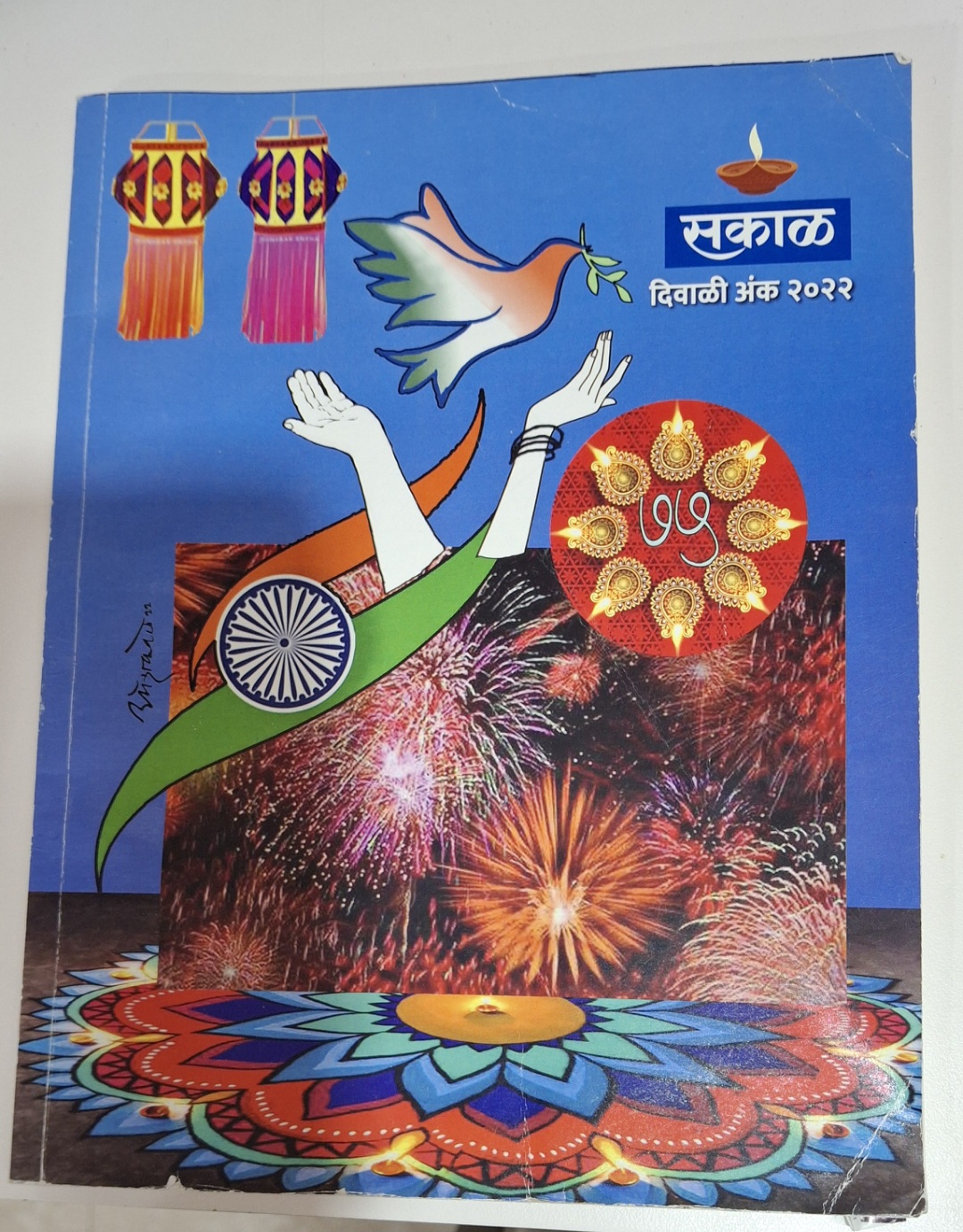
Among the magazines, Sakal Magazine holds a notable presence in the district, particularly for its Diwali Ank (Diwali issue).
Jatra is a humorous Marathi magazine published annually during the Diwali season, renowned for its colorful illustrations and light-hearted content. Widely enjoyed by readers across Maharashtra, it also maintains a local readership.
Champak, a well-known Marathi children’s magazine, locals say was especially popular in the 1990s as a primary source of entertainment for children. However, with the rise of digital entertainment, its readership has declined in recent years.
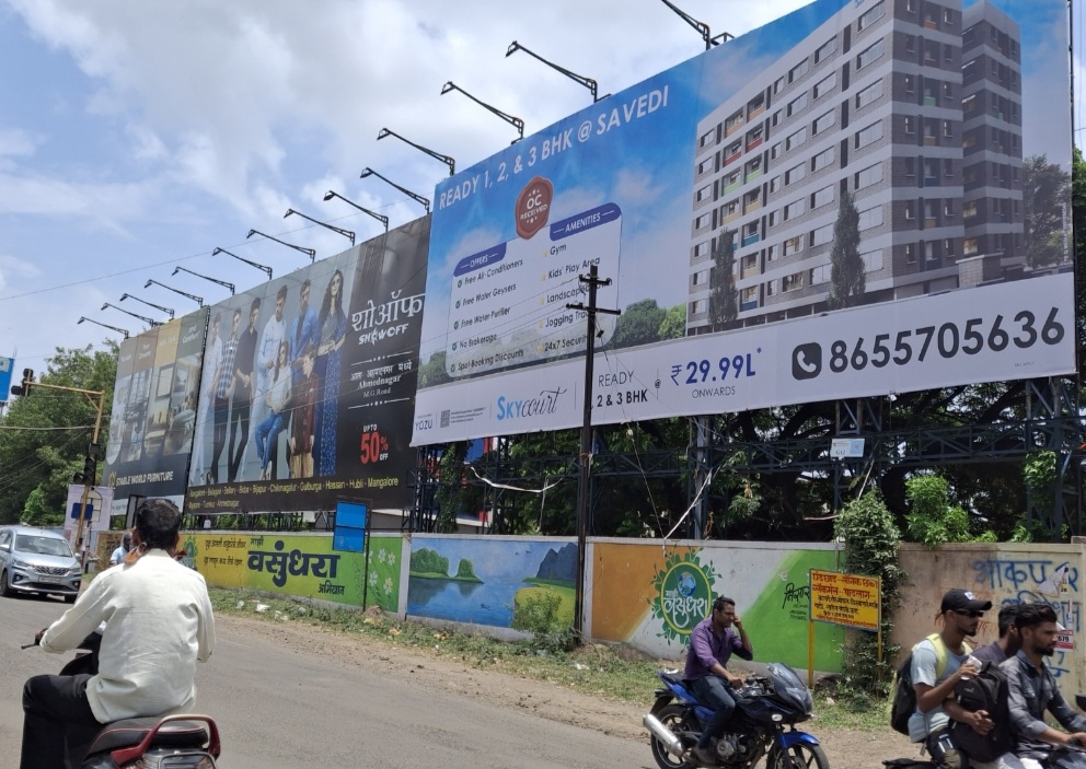
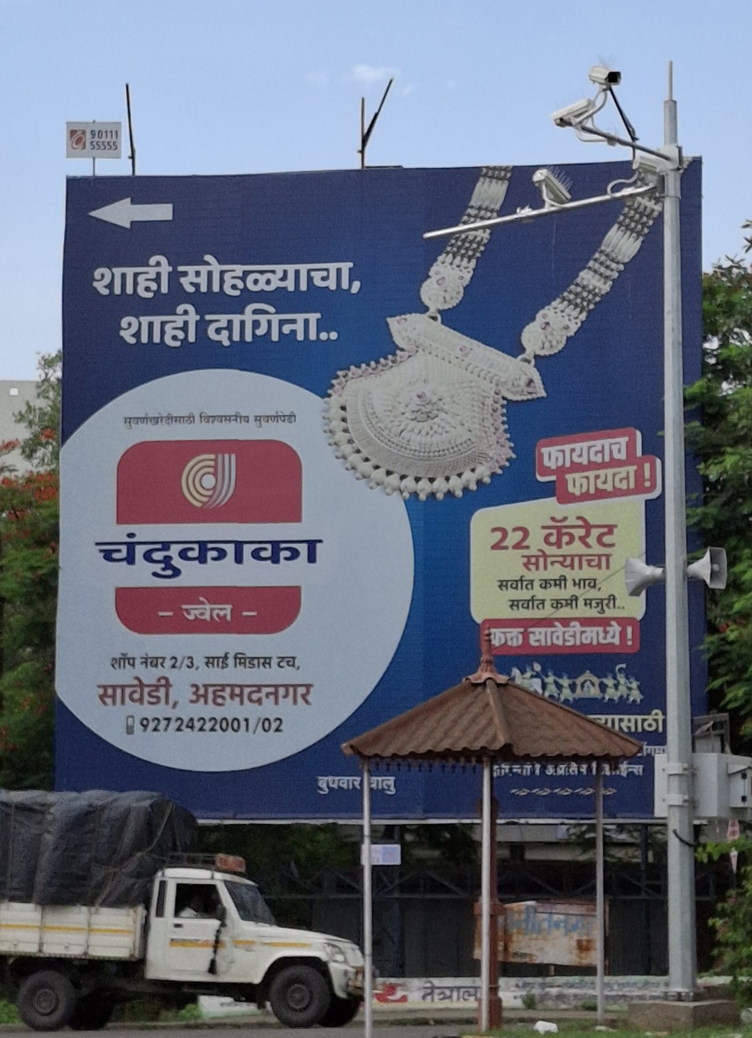
What’s on the Billboards? A Look at Ahilyanagar’s Hoardings
In the realm of advertising, real estate promotions have become a prominent feature on billboards across the district, capturing the attention of both residents and visitors alike. This trend reflects the booming property market in the area, where developers are eager to showcase new projects and attract potential buyers. The prevalence of real estate ads signifies not just growth in the sector but also a shift in community interest towards property investment.
In addition to real estate, advertisements for jewelry stores have become increasingly common in Ahilyanagar city. Over the past three to four years, several new jewelry shops have opened, leading to a surge in promotional campaigns that emphasize fine jewelry and luxury items.

Aside from this, billboards frequently promote upcoming local events such as marathons and cultural festivals. These advertisements serve as important communication tools, keeping residents informed about key happenings in the city.

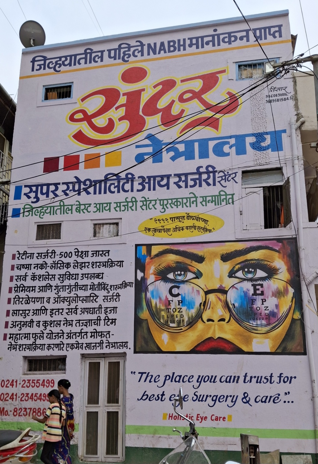
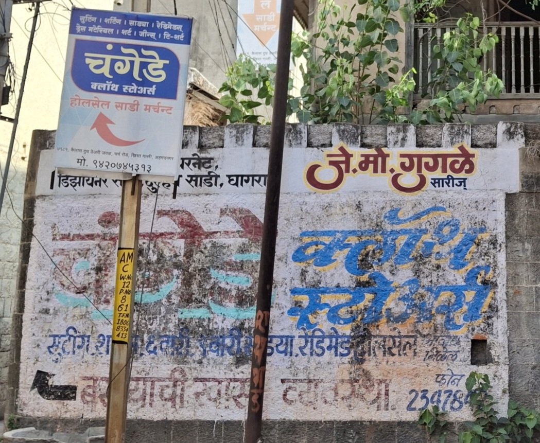
Additionally, hand-painted wall advertisements add a unique charm to the urban landscape of Ahilyanagar. These murals, often promoting local businesses and services, contribute to the city’s visual identity while maintaining a traditional form of marketing that resonates with the community.
Graphs
Road Safety and Violations
Transport Infrastructure
Bus Transport
Communication and Media
Sources
Amruta Chougule. 2022. शहर बस थांबे बनलेत तळीरामांचे अड्डे; तिकीट घराचा होतोय मुतारीसारखा वापर Pudhari News.https://pudhari.news/latest/ahmednagar-trans…
Dhaval Kulkarni. 2019.Shirdi Airport’s Prospects Soar as Maharashtra Govt Okays Development Plans.DNA India, India.https://www.dnaindia.com/india/report-shirdi…
Gazetteers of the Bombay Presidency. 1884 (Reprinted in 2003, e-Book Edition 2006).Gazetteers of the Bombay Presidency: Ahmadnagar District, Volume XVII.Gazetteer Department, Government of Maharashtra, Mumbai.
Maharashtra State Gazetteers. 1976.Ahmadnagar District.Gazetteers Department, Government of Maharashtra, Mumbai.
Mangalam Maloo. 2024.Decoding the Most Popular Temple Towns of India and the Accompanying Tourist Economy.CNBC-TV18.https://www.cnbctv18.com/travel/culture/deco…
Shekhar Singh. 2024.Jewar, Pune, and Shirdi Among 21 Greenfield Airports Poised to Revolutionize Skyways.Bizz Buzz.https://www.bizzbuzz.news/national/jewar-pun…
World Health Organization.Road Safety.WHO, Geneva.https://www.who.int/health-topics/road-safet…
Last updated on 6 November 2025. Help us improve the information on this page by clicking on suggest edits or writing to us.