Contents
- History
- Ancient Trade Routes
- Modes of Transportation in the District
- Waterways and Ferries
- Train and Rail Systems
- Bus Networks
- Autos & Shared Vehicles
- Traffic Map
- Communication Networks
- Newspapers & Magazines
- Radio & Broadcasting
- What’s on the Billboards? A Look at Ratnagiri’s Hoardings
- Post Offices
- Graphs
- Road Safety and Violations
- A. Cases of Road Safety Violations
- B. Fines Collected from Road Safety Violations
- C. Vehicles involved in Road Accidents
- D. Age Groups of People Involved in Road Accidents
- E. Reported Road Accidents
- F. Type of Road Accidents
- G. Reported Injuries and Fatalities due to Road Accidents
- H. Injuries and Deaths by Type of Road
- I. Reported Road Accidents by Month
- J. Injuries and Deaths from Road Accidents (Time of Day)
- Transport Infrastructure
- A. Household Access to Transportation Assets
- B. Length of Roads
- C. Material of Roads
- Bus Transport
- A. Number of Buses
- B. Number of Bus Routes
- C. Length of Bus Routes
- D. Average Length of Bus Routes
- E. Daily Average Number of Passengers on Buses
- F. Revenue from Transportation
- G. Average Earnings per Passenger
- Communication and Media
- A. Household Access to Communication Assets
- B. Newspaper and Magazines Published
- C. Composition of Publication Frequencies
- Sources
RATNAGIRI
Transport & Communication
Last updated on 6 November 2025. Help us improve the information on this page by clicking on suggest edits or writing to us.
History
Ancient Trade Routes
In the Konkan region, where the present-day Ratnagiri district is located, many routes passing through the district were historically vital for trade, particularly due to the region’s strategic location along the Arabian Sea and its rugged terrain that favored coastal transport over land-based travel.
Historical records and literary sources suggest that Ratnagiri was closely integrated into wider Indian Ocean trade networks. The Periplus of the Erythraean Sea, a 1st-century CE Greek text describing maritime commerce, references several trade ports along India’s western coastline. One of these ports, Palaepatmai, has been identified by scholars with present-day Palshet in Ratnagiri. Archaeological and epigraphic evidence indicates that this port remained active from the early centuries of the Common Era through to the 17th century, underscoring its long-standing economic relevance.
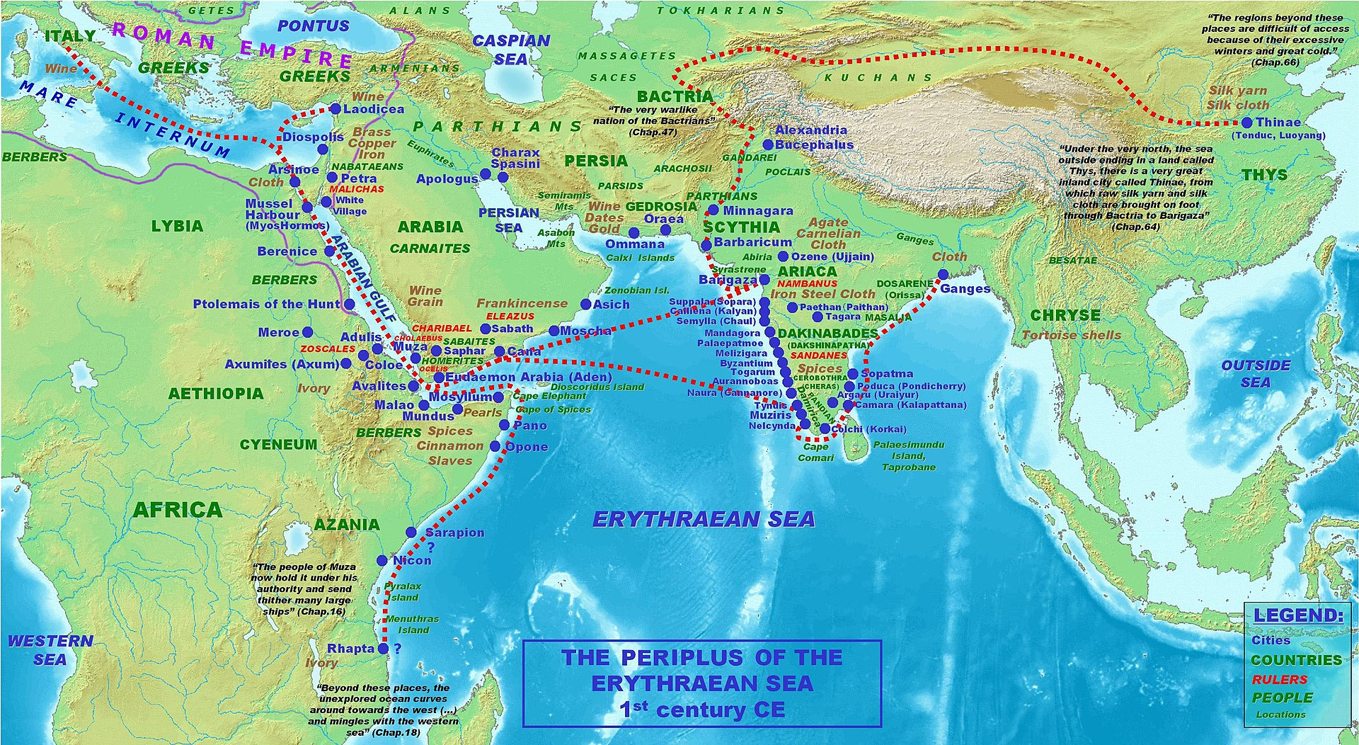
In addition to Palshet, other significant coastal settlements included Bankot (in present-day Mandangad taluka), Dabhol (in Dapoli taluka), and Ratnagiri itself. Among these, Dabhol gained prominence during the medieval period. The 15th-century Russian traveler Afanasy Nikitin described Dabhol as a bustling port linked to major trading regions, noting “the horses from Mysore, Arabia, Khorasan and Nighostan were brought here for trade. This was the place that had links with all major ports from India to Ethiopia.” His account reveals the far-reaching connections the district maintained during both ancient and medieval times.
Accounts of travel within the region can be found in the colonial district Gazetteer (1880), which describes how “carriage [in the district] was almost entirely by water,” as inland roads were scarce, narrow, and poorly maintained. In this rugged terrain, a network of hill passes was noted to be crucial for connecting coastal areas to the interior, and four main passes, namely Kumbharli, Amba, Phonda, and Parpoli, were referred to as "the most important" routes for trade with regions such as the Deccan and Karnataka.
When it comes to modes of transport, early British accounts suggested that wheeled vehicles were rare, and goods, particularly in remote or hilly areas, were often carried manually or by bullocks. While some of these descriptions can also possibly reflect administrative frustrations or colonial exaggerations rather than an accurate portrayal of local economies, they nonetheless highlight the infrastructural limitations that shaped trade routes and travel at the time.
From the mid-1800s, road building began to expand. By the 1860s, it is noted in the Gazetteer that there were around “170 miles of roads” in the district. Over the next few decades, this increased to more than 500 miles, including cart tracks and bullock routes. These helped improve access between villages, ports, and inland towns. Notably, during the famine of 1876–77, this growing road network made it possible to transport large quantities of grain from the coast to the interior.
Modes of Transportation in the District
Waterways and Ferries
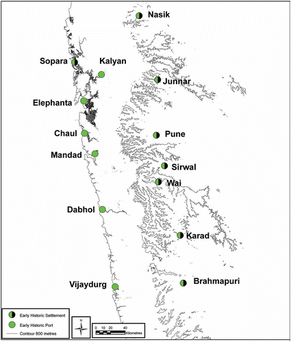
Water transport has historically been integral to Ratnagiri’s trade, as illuminated above. It has also played a major role in daily commutes for locals and tourists. The district is intersected by several rivers and creeks, such as the Savitri, Vashishti, and Shastri, which once served as key routes for ferry services and small cargo vessels.
According to the colonial district Gazetteer (1880), steamers and boats of various sizes formed an integrated network that connected coastal towns with the interior and beyond. Smaller steamers operated by the Shepherd Company, weighing between 160 and 199 tons, catered to local traffic, including a popular route from Bombay to the Bankot River, which took about eight to nine hours. These were sometimes referred to as Dharamtar steamers.
Larger vessels belonging to the British India Steam Navigation Company, ranging from 1,900 to over 2,600 tons, also served Ratnagiri. These carried mail and cargo and connected the district to major cities like Madras and Calcutta, making Ratnagiri part of a broader Indian Ocean trade circuit.

Alongside steamers, a wide range of sailing vessels frequented the Konkan coast. Foreign ships, particularly from Arabia, are described to have been docked at ports like Jaitapur in Ratnagiri district, bringing goods such as dates and horses, while loading local produce for return voyages. Locally built boats of varying types, with names such as the shibadi, phatemari, machva, and ulandi, played key roles in cargo transport and fishing.
Interestingly, Ratnagiri is noted to have been a prominent shipbuilding hub in the 18th and 19th centuries. Boats were constructed using local timber by skilled artisans from communities such as the Sutars, Pachkalsis, and Gabits. It is recorded in the Gazetteer that teak, and even bantek, jack, mango, and the light dhup trees were used by shipbuilders. However, numerous factors such as the depletion of teak forests and the rise of industrial shipbuilding gradually led to a decline in this craft. By the early 20th century, overland travel seemed to have begun to take precedence.
Train and Rail Systems
As waterborne trade and coastal navigation began to decline in the early 20th century, in part due to infrastructural challenges and in part due to the rise of more reliable overland routes, attention gradually shifted toward rail-based transport. It is important to note that Ratnagiri district remained relatively isolated from major railway networks for much of the 20th century. This began to change with the ambitious Konkan Railway project, which would eventually redefine connectivity along India’s western coast.
The region’s rail infrastructure is primarily shaped by the Konkan Railway, which was established in 1990 to construct a continuous rail line between Roha (Raigad district, Maharashtra) and Thokur (near Mangalore, Karnataka). The line, stretching over 760 km at the time, became operational on 26 January 1998.
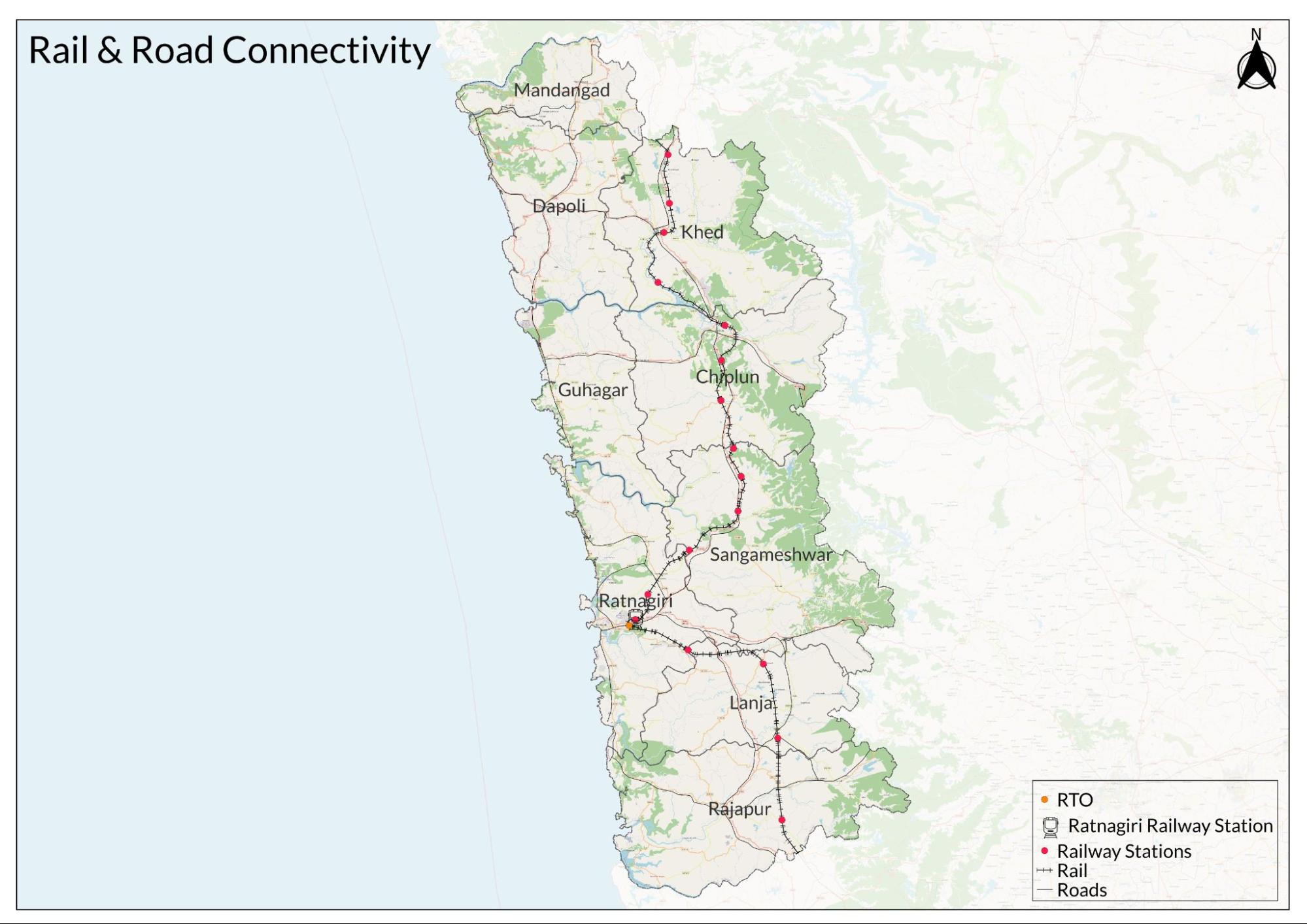
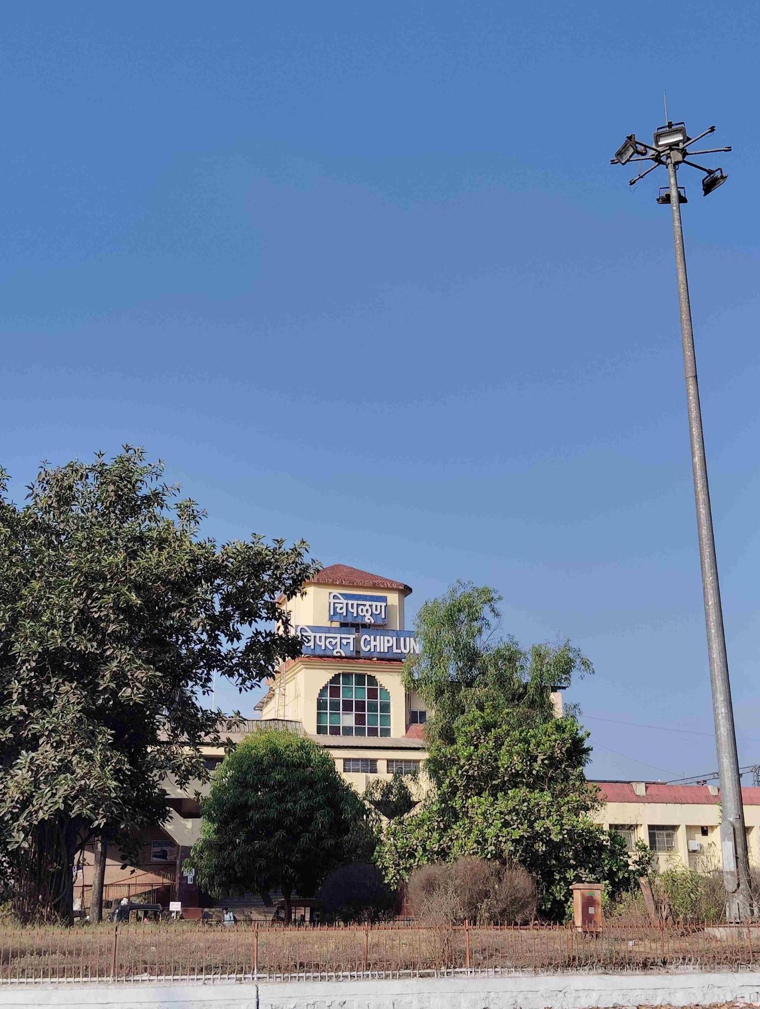
Within Ratnagiri district, important stations such as Chiplun, Khed, Ratnagiri, Rajapur Road, and Nivasar provide direct rail connectivity to Mumbai, Goa, and Mangalore. Over the past two decades, several stations along the route have undergone upgrades, with improvements in platforms, facilities, and station aesthetics.
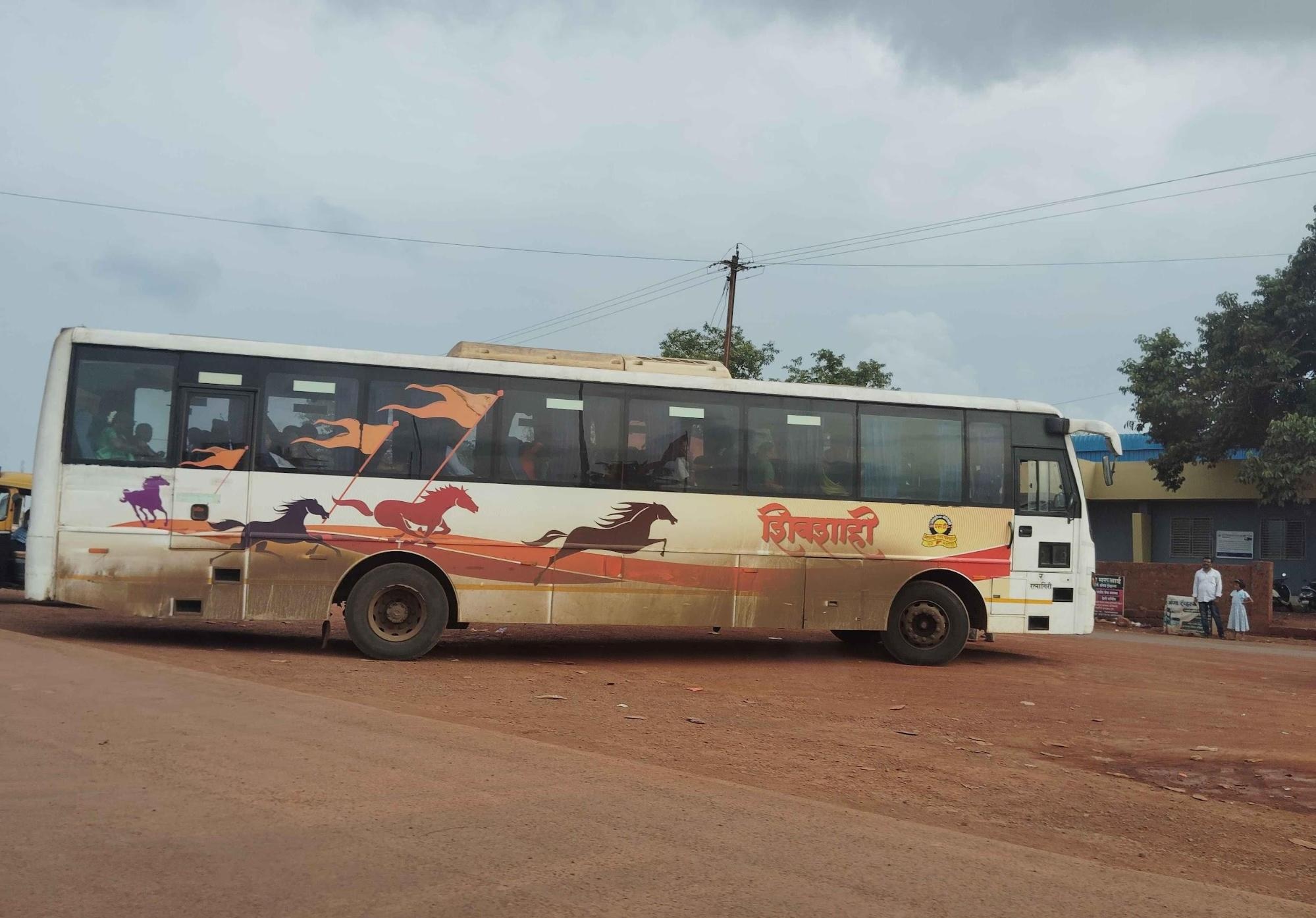
Bus Networks
Ratnagiri is serviced by an extensive network of state-run and private buses, operated primarily by the Maharashtra State Road Transport Corporation (MSRTC).
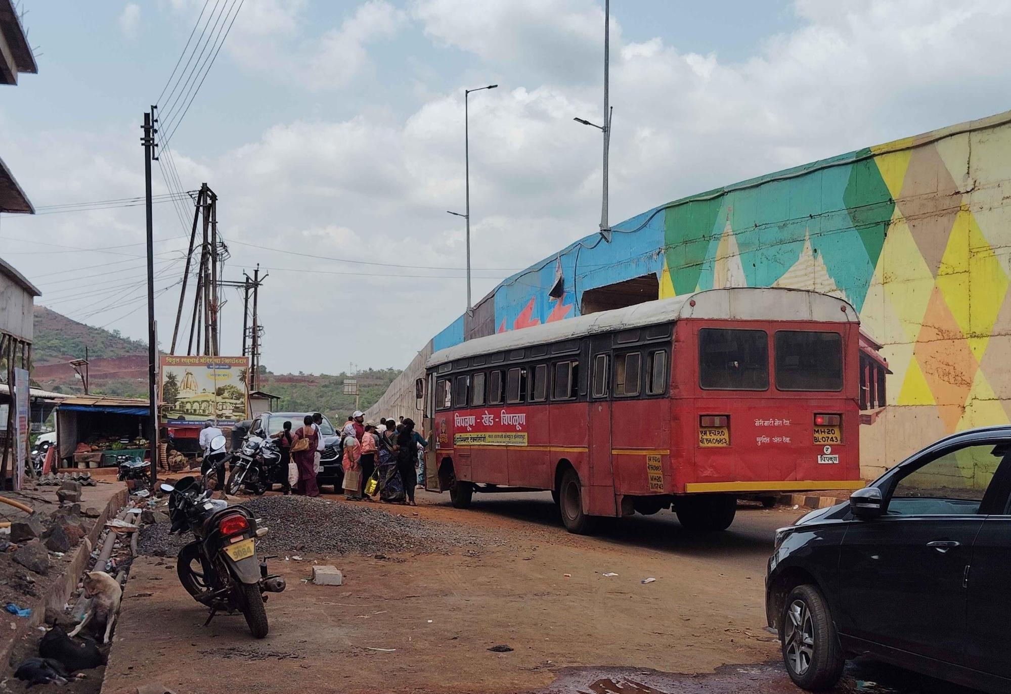
In earlier decades, locals say that red-colored buses, popularly known as "Lal Dabba," were a familiar sight. However, these have largely been replaced by newer models, including the green "Hirkani" buses and the air-conditioned "Shivshahi" buses for inter-district travel.
In recent years, special efforts have been made to improve transport access for vulnerable groups. Notably, locals say that individuals over the age of 60 now travel free of charge on MSRTC buses under a state welfare scheme. Despite improvements, residents in remote or hilly areas still report infrequent service, particularly in monsoon months or in less connected talukas.
Autos & Shared Vehicles
Across towns and villages in Ratnagiri, private auto-rickshaws and six-seaters, colloquially called "Dum Dums," serve as the most accessible means of local transport. These vehicles are known for their vibrant designs, often adorned with colorful lettering, artificial flowers, and religious motifs reflecting the driver’s personal beliefs.
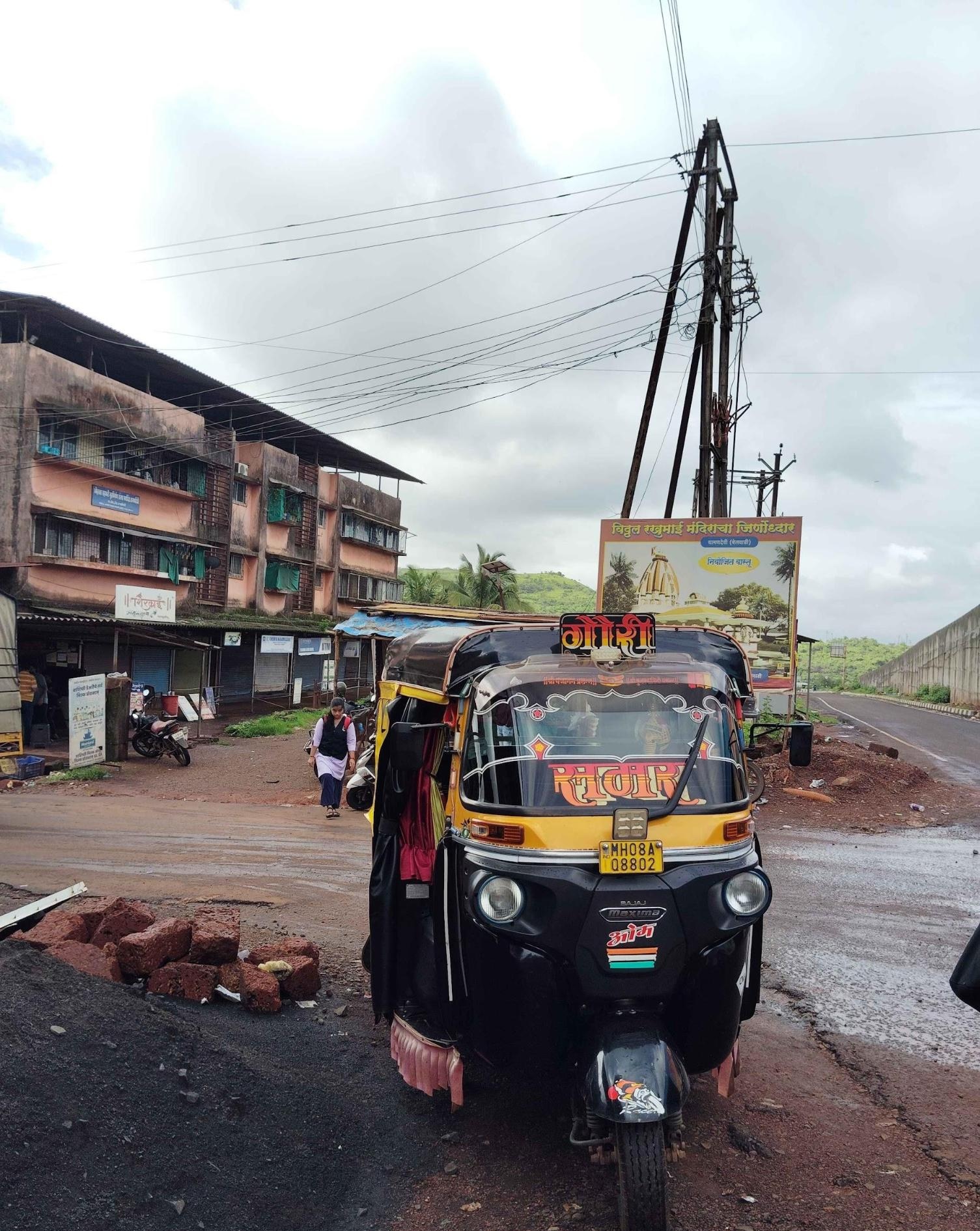
Fares are usually negotiated rather than metered, especially in rural areas. These autos are commonly used for short-distance travel within and between villages, mostly in areas with limited bus coverage.
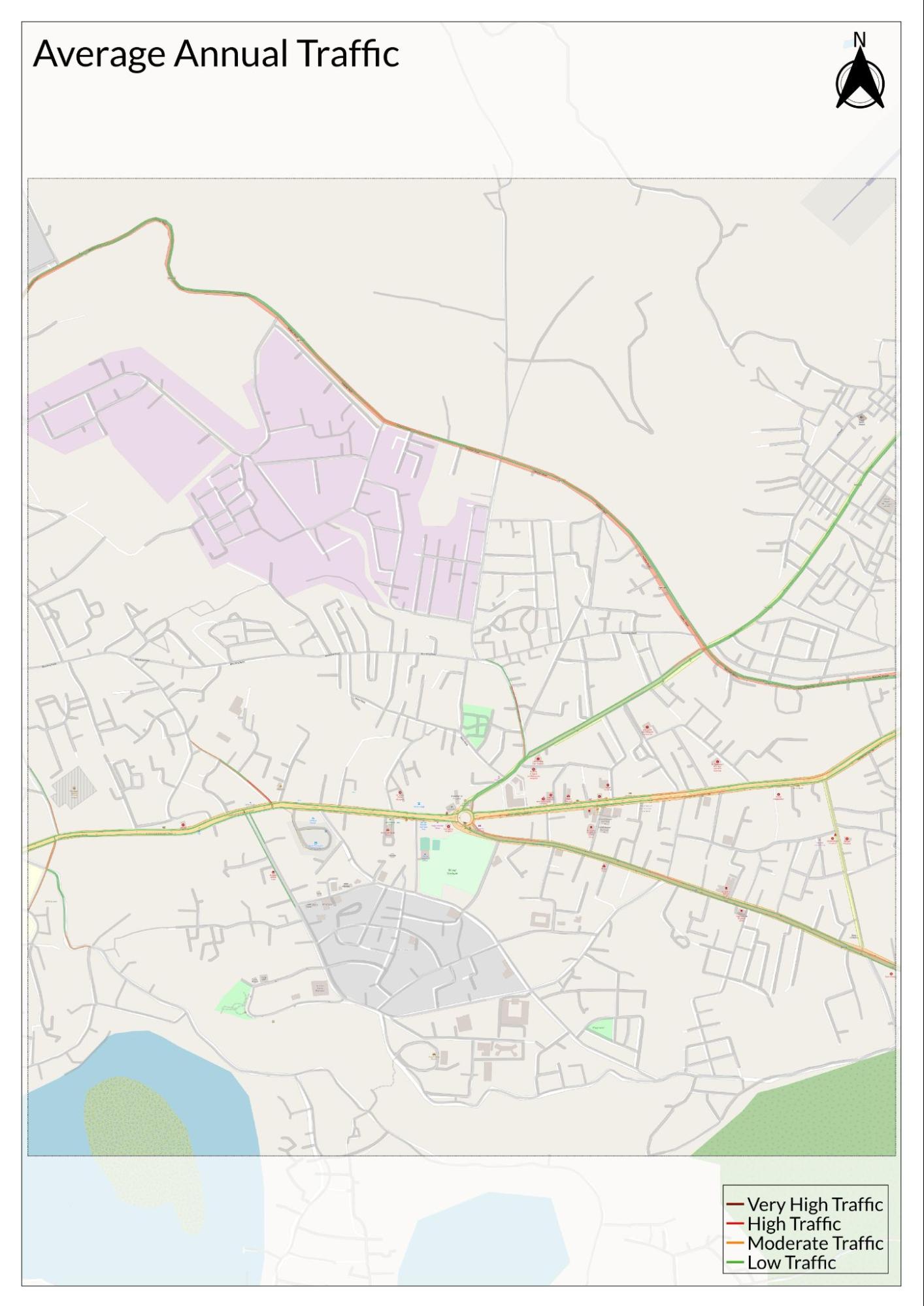
Traffic Map
Communication Networks
Newspapers & Magazines
Ratnagiri district has a long-standing tradition of regional journalism, with several newspapers contributing to public discourse and local awareness. One of the oldest publications in the region is Saptahik Satyashodhak, first published in 1871. Ratnagiri Times is another locally focused daily, known for its reporting on civic issues, events, and cultural developments within the district.
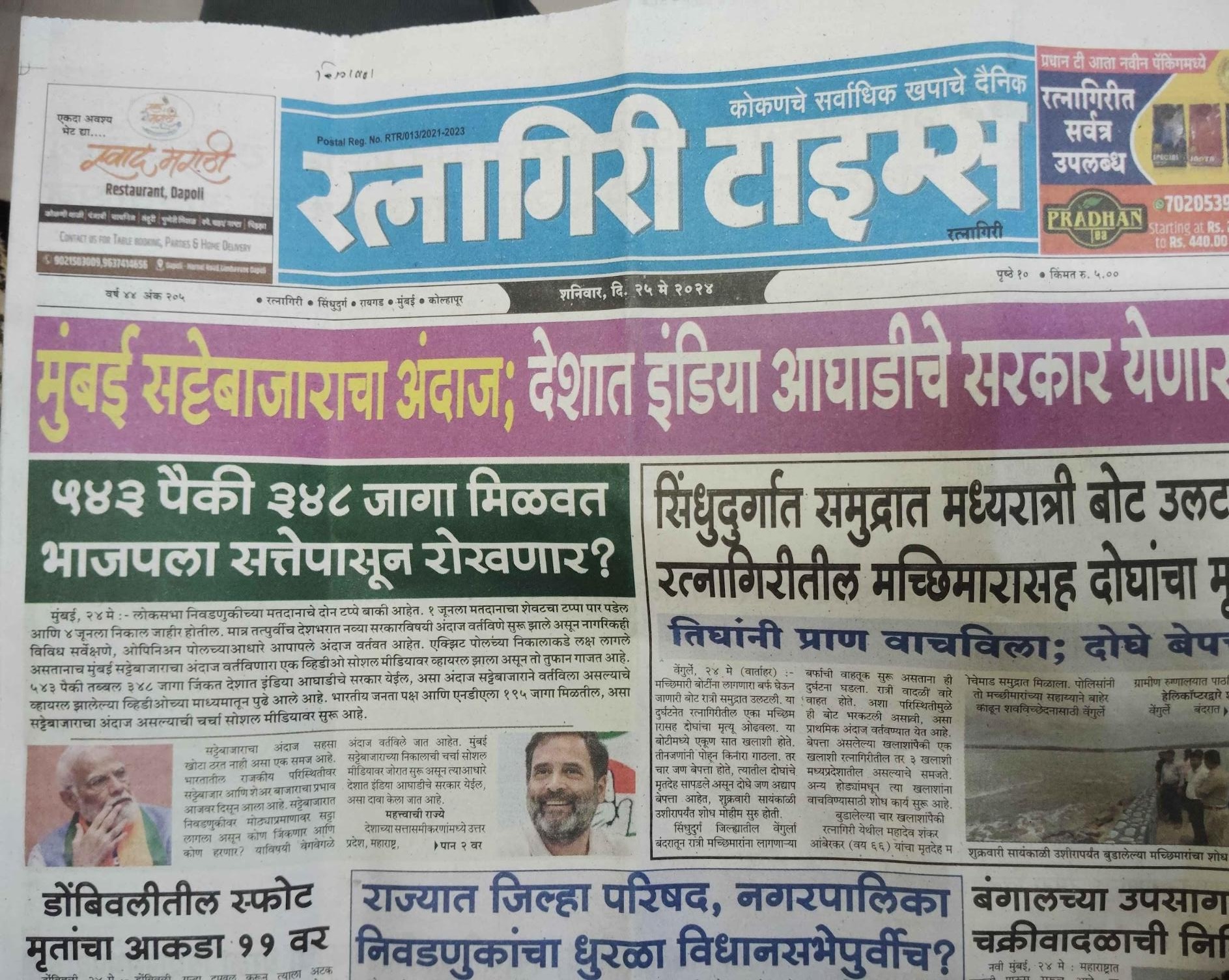
Additional Marathi-language dailies such as Lokmat (featuring a district-specific edition called Hello Ratnagiri), Pudhari, Samna, Mahanagari Times, and Sakal form a core part of the media landscape. These publications cater to a broad readership and contribute to information dissemination across both urban and rural areas.
Magazines and weekly periodicals are also accessible through local libraries and newsstands, covering topics such as agriculture, government schemes, and social issues. Locals say that while print remains popular, digital versions of these newspapers are increasingly used by younger readers.
Radio & Broadcasting
Ratnagiri district is served by one government-run radio station, Akashvani Ratnagiri (AIR Ratnagiri), under the All India Radio network. The station broadcasts primarily in Marathi and provides a range of programming, including news bulletins, music, cultural features, and public interest segments.
Locals point out that a notable aspect of AIR Ratnagiri is its dedicated programming for farmers and rural communities. These include updates on agricultural practices, market prices, weather forecasts, and expert interviews aimed at disseminating information relevant to the local economy and environment.
What’s on the Billboards? A Look at Ratnagiri’s Hoardings
Outdoor advertisements and hoardings are a common feature across Ratnagiri’s urban centers and highways. These typically include political messages, public notices, advertisements for local businesses, and announcements related to cultural or religious events. Locals say that in smaller towns and villages, hoardings often feature community-centered messaging, such as celebratory greetings or local inaugurations of Mandirs.
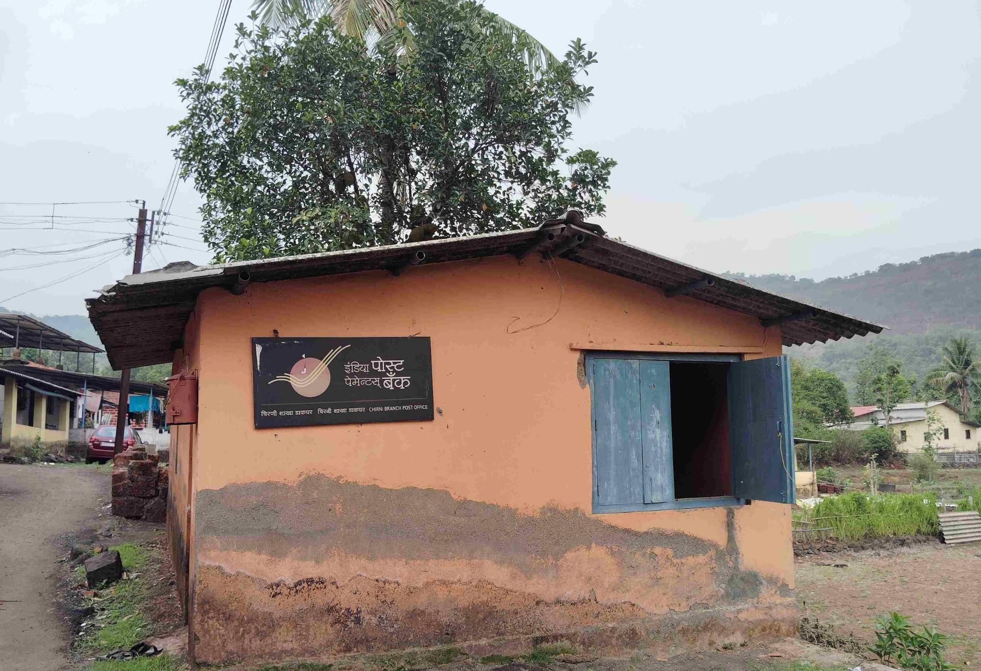
Post Offices
India Post maintains a widespread presence across the Ratnagiri district, including in rural and semi-urban areas. Post offices continue to offer services such as mail delivery, money orders, savings schemes, and pension disbursement.
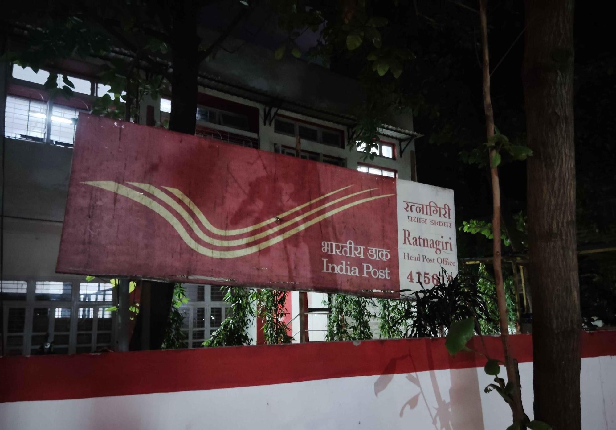
Despite the growing use of digital communication platforms, post offices remain important in many villages where internet connectivity may be limited. Services such as the Post Office Savings Bank (POSB) continue to be utilized, particularly among senior citizens and rural households.
Graphs
Road Safety and Violations
Transport Infrastructure
Bus Transport
Communication and Media
Sources
Ashok Marathe. 2004-5. Contribution Of The Deccan College To The Study Of Prehistoric And Historical Archaeology Of Konkan. Vol. 64/65. Vice Chancellor, Deccan College Post-Graduate and Research Institute (Deemed University), Pune.https://www.jstor.org/stable/42930632?seq=4
Himanshu Prabha Ray. 1987. Early Historical Urbanization: The Case of the Western Deccan. Vol.19. Taylor & Francis, Ltd.https://www.jstor.org/stable/124501?seq=1
James M. Cambell. ed. 1880. Gazetteer of the Bombay Presidency vol. X. Ratnagiri and Savantvadi. Government Central Press, Bombay.
Konkan Railway. 2015. Konkan Railway to Establish Tunnel Technology Institute at Goa as a Part of Its Silver Jubilee Celebration! Konkan Railway Corp Ltd.https://konkanrailway.com/en/node/3364
N.T. Monc, P.M. Joshi, et al. 1962. Maharashtra State Gazetteers: Ratnagiri District. Bombay, Government Printing, Stationery and Publications.https://archive.org/details/dli.ministry.084…
Tilok Thakuria. 2017. Society and Economy during Early Historic Period in Maharashtra: An Archaeological Perspective. Journal of Multidisciplinary Studies in Archaeology.http://www.heritageuniversityofkerala.com/Jo…
World Health Organization. Road Safety. WHO, Geneva.https://www.who.int/health-topics/road-safet…
Last updated on 6 November 2025. Help us improve the information on this page by clicking on suggest edits or writing to us.