Contents
- History
- Ancient Trade Routes
- Modes of Transport in the District
- Train and Rail Systems
- Overview of Bus Networks
- Autos & Shared Vehicles
- Ferries & Water Transport
- Traffic Map
- Communication Networks
- Newspapers & Magazines
- Radio & Broadcasting
- Posts & Inland Letters
- Graphs
- Road Safety and Violations
- A. Cases of Road Safety Violations
- B. Fines Collected from Road Safety Violations
- C. Vehicles involved in Road Accidents
- D. Age Groups of People Involved in Road Accidents
- E. Reported Road Accidents
- F. Type of Road Accidents
- G. Reported Injuries and Fatalities due to Road Accidents
- H. Injuries and Deaths by Type of Road
- I. Reported Road Accidents by Month
- J. Injuries and Deaths from Road Accidents (Time of Day)
- Transport Infrastructure
- A. Household Access to Transportation Assets
- B. Length of Roads
- C. Material of Roads
- D. Licenses Issued
- Bus Transport
- A. Number of Buses
- B. Number of Bus Routes
- C. Length of Bus Routes
- D. Average Length of Bus Routes
- E. Daily Average Number of Passengers on Buses
- F. Revenue from Transportation
- G. Average Earnings per Passenger
- Communication and Media
- A. Household Access to Communication Assets
- B. Newspaper and Magazines Published
- C. Composition of Publication Frequencies
- Sources
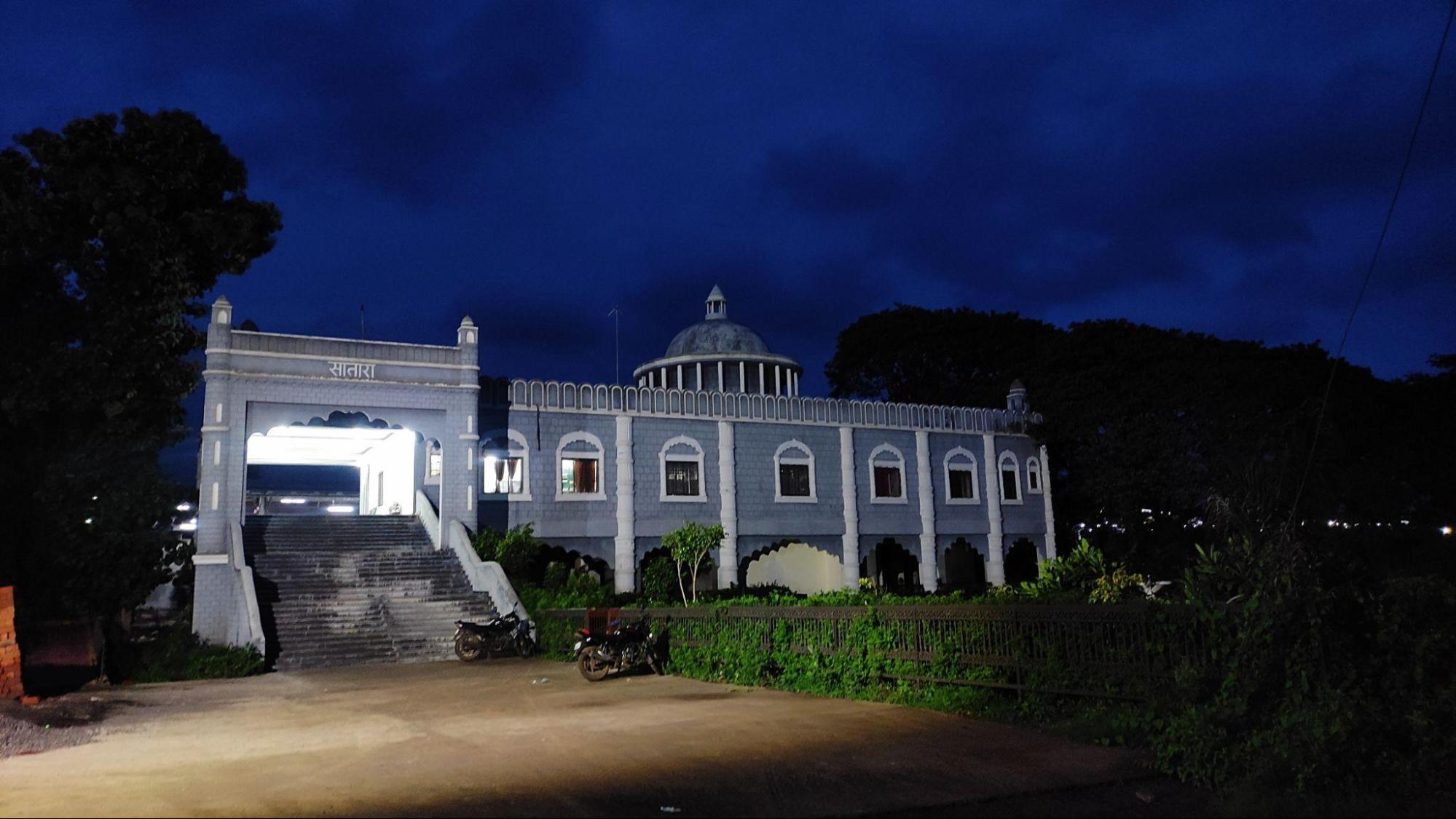
SATARA
Transport & Communication
Last updated on 6 November 2025. Help us improve the information on this page by clicking on suggest edits or writing to us.
History
Ancient Trade Routes
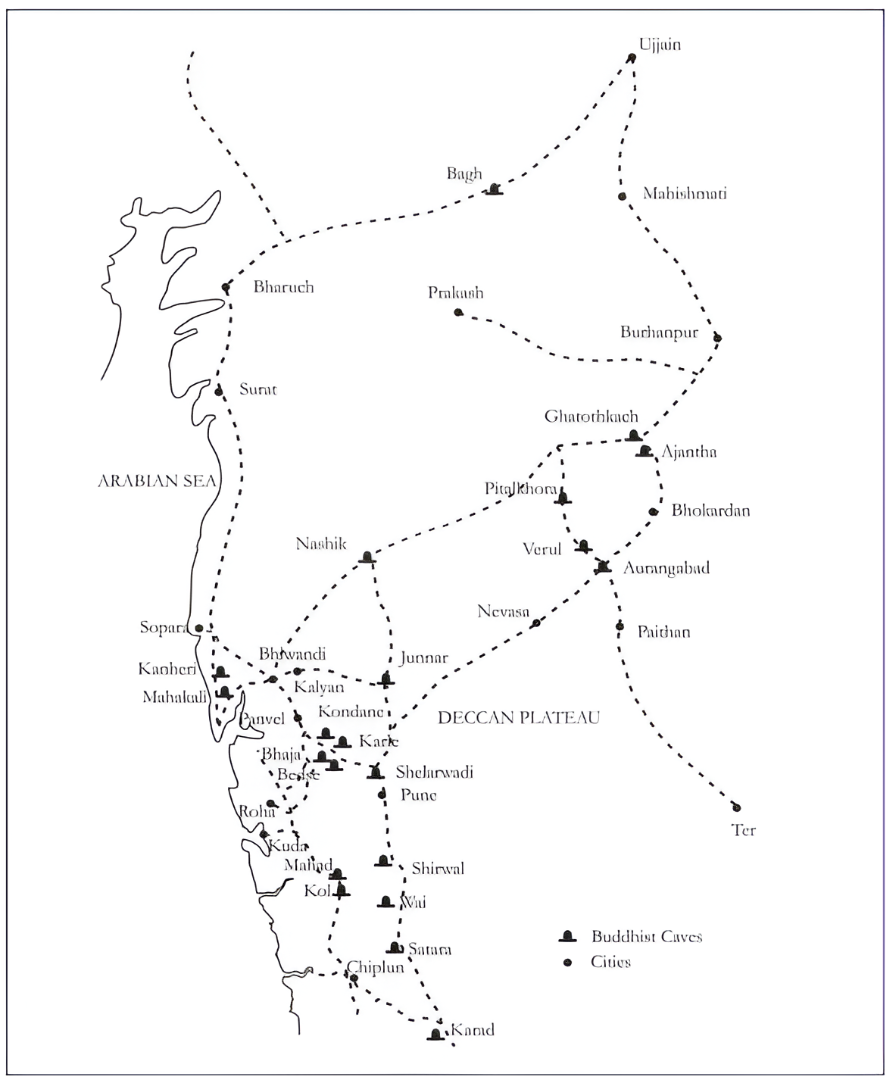
The Deccan region, including present-day Satara district, was part of a broader network that connected inland settlements with coastal trading centres via passes through the Western Ghats. These routes enabled commercial activity while also supporting the spread of religious traditions, particularly Buddhism.
Scholars have noted that Buddhist monastic establishments were often located along these trade routes. Monasteries served not only as religious centres but also as resting places for travelling merchants and pilgrims. As a result, Buddhist cave sites are frequently found near ancient paths of movement across the Deccan region. Satara, too, is home to many such cave sites.
Karad is one such place where a cluster of more than 60 early Buddhist caves has been discovered. The district Gazetteer (1885) notes that one of these caves bears an inscription dating to the 1st century CE, underscoring the antiquity and significance of the site.
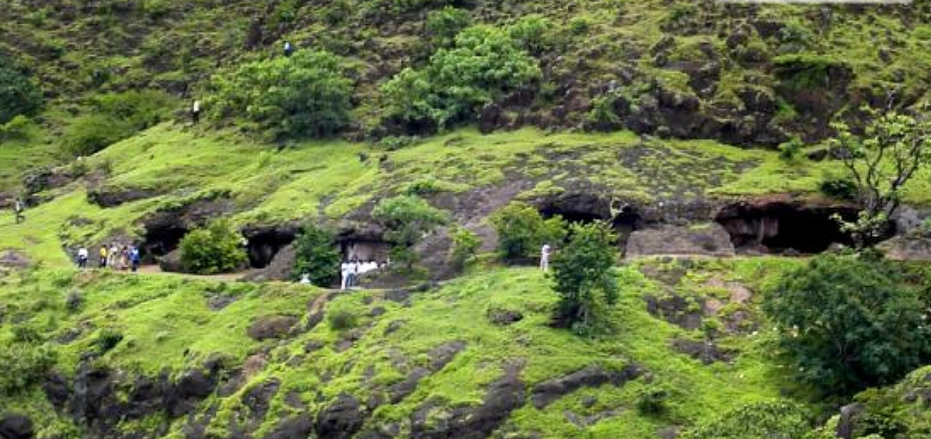
Further north, near Wai, the Shirwal Caves offer additional evidence of early Buddhist presence in the district. Situated in what was formerly Jivli village (now part of Jawali), this group consists of simple monastic structures believed to have served religious communities and travellers alike.
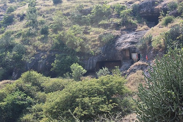
More recently, field research by Maitreyee Bhosekar (2021) documented a previously unrecorded cave site in Renevasti, near Wai. Bhosekar suggests “nearly all the Buddhist caves (here) are excavated on or are seen near the ancient trade route” and these sites were likely positioned along a significant inland trade corridor stretching from Kolhapur to Bharuch (a major trade centre in Gujarat), passing through Karad, Satara, Wai, Shirval, Pune, and Shelarwadi, and linking further to centres such as Junnar and Nashik.
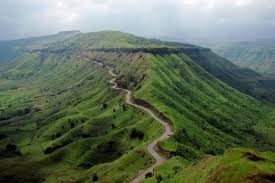
In addition to inland connections, Satara’s location along the Western Ghats gave it access to important mountain passes. The Varandha Ghat and Kumbharli Pass linked the interior to Konkan ports such as Mahad (Raigad district), Dabhol, and Chiplun in present-day Ratnagiri district. These trading passes are noted in the district Gazetteer (1885) to have gained much prominence after the British made them navigable by carts in the 19th century. It is noted here that “a large amount of traffic was destined to the ports on the Konkan coast, especially to Ratnagiri, Chiplun, Bankot, and Mahad.”
Modes of Transport in the District
Train and Rail Systems
Satara district is served by sections of the Pune–Miraj and Pune–Bangalore railway lines, providing both passenger and freight connectivity. The district falls under the Pune Division of Central Railways, and includes key stations such as Satara (STR), Karad, Lonand, Koregaon, Wathar, and Rahimatpur. Rail connectivity plays an important role in supporting regional mobility, economic activity, and access to urban centers such as Pune, Kolhapur, and Sangli. Stations like Karad have historically served industrial needs, such as in the transportation of goods for the Koyna Hydroelectric Project as noted in the district Gazetteer, while Wathar station facilitates tourism to nearby hill stations like Mahabaleshwar and Panchgani.
The railway infrastructure in the district has a long and interesting history. Railway construction in the district began in the 1880s, with the arrival of the Southern Maratha Railway Company. The line was later managed by the Madras and Southern Mahratta Railway (M. & S. M. Railway), and eventually came under government control in 1944. Following the regrouping of Indian Railways in 1952, Satara’s lines were integrated into the national railway system.
Interestingly, it is noted in the district Gazetteer (1963), that due to the district’s rugged terrain and the cost of bridging the Krishna River and its tributaries, the railway alignment was laid along the river’s eastern side. This placement resulted in several towns, including Satara and Karad, being located at some distance from the main line.
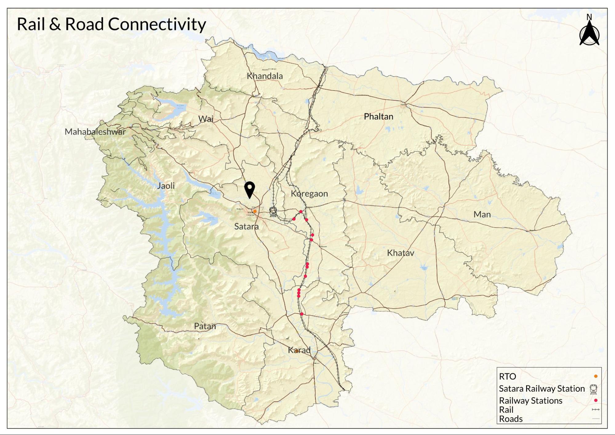
Today, the rail network continues to support both daily travel and long-distance connectivity, although certain interior areas of the district remain more dependent on road-based transport due to distance from railway access points.
Overview of Bus Networks
Public bus services in Satara district are operated by the Maharashtra State Road Transport Corporation (MSRTC). The current network connects major towns such as Satara, Karad, Wai, Mahabaleshwar, and Phaltan, along with various rural talukas. Services link the district to cities including Pune, Kolhapur, Sangli, and Mumbai.
While the bus network is generally extensive, locals say that challenges remain in hilly and remote regions, particularly in Jaoli and Mahabaleshwar talukas, where narrow roads and seasonal tourism can cause congestion. In such areas, bus frequency is limited, and residents often walk several kilometres to access the nearest service. These limitations highlight ongoing gaps in transport equity across the district.
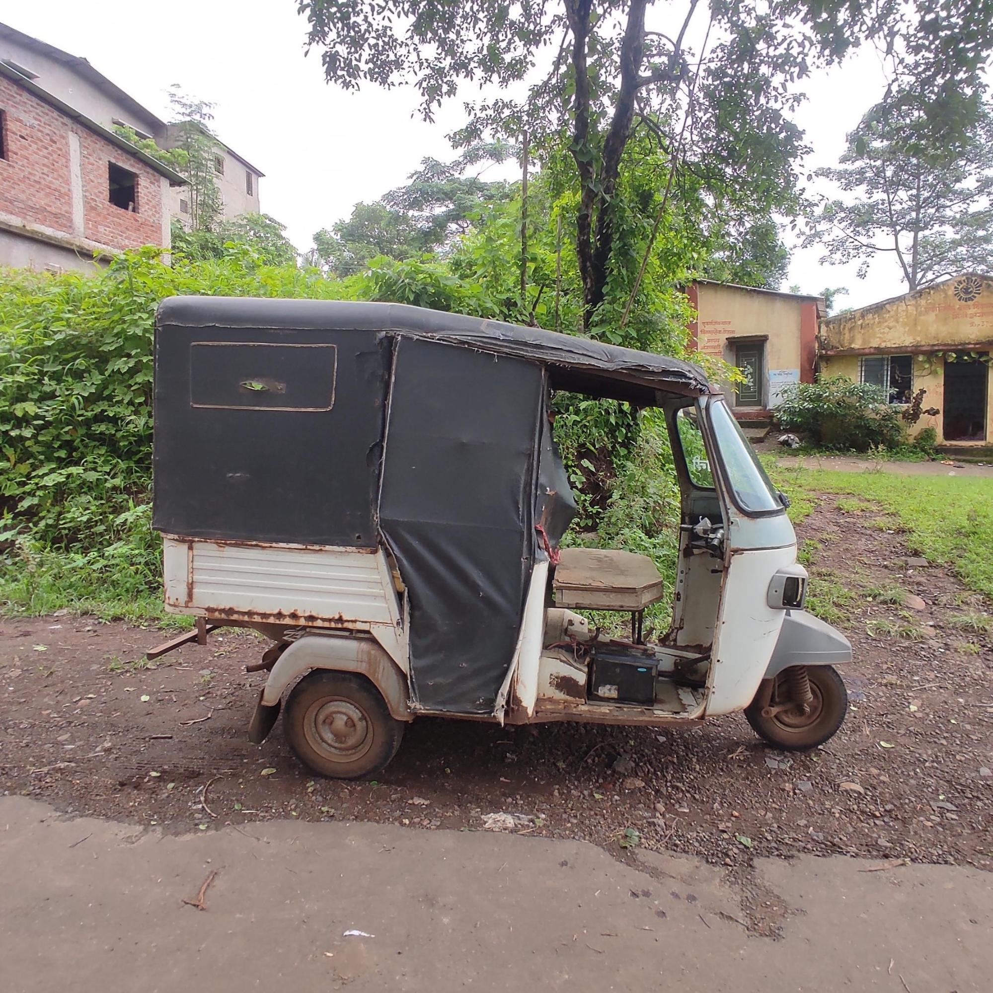
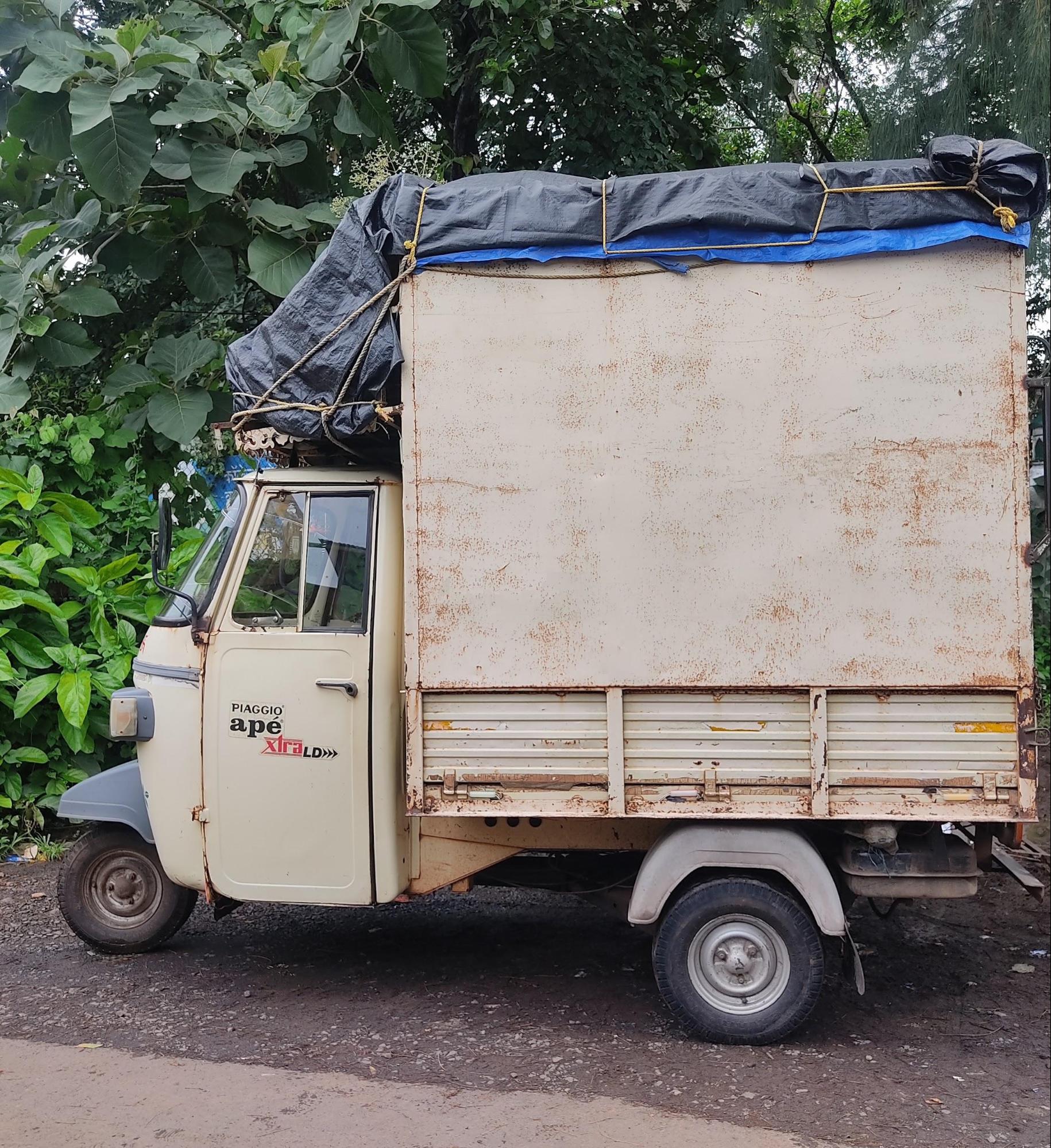
Autos & Shared Vehicles
Within the district, residents depend on a mix of informal transport options. Auto-rickshaws, shared jeeps (locally known as vadaap), and tempos are widely used, particularly in areas where buses are infrequent. Locals say that autos rarely use meters, and fares are generally negotiated. App-based cab services like Ola and Uber have a limited presence, mostly restricted to larger towns.
Longer local journeys, for religious gatherings or social events, are often arranged using shared minibuses or hired vehicles, reflecting a community-based approach to transport.
Ferries & Water Transport
Historically, ferry crossings were a vital part of Satara’s transport system, particularly during the monsoon. As recorded in the colonial district Gazetteer (1885), twelve ferries operated seasonally across the Krishna, Koyna, and Varna rivers. Eight of these crossed the Krishna River at points such as Mahuli and Dhamner. These services, operated and maintained largely by the Public Works Department, used wooden boats and iron pontoons.
Following the construction of bridges and improvements in road infrastructure in the post-Independence period, ferry usage declined sharply. By the late 20th century, major crossings had shifted to seasonal points such as Nimbin-Gove and Bamnoli.
Today, locals say that the use of boats as a mode of transport continues in specific areas, particularly across the Koyna backwaters in Jaoli and Mahabaleshwar talukas. Boats run daily, offering a 15-minute crossing in areas where road alternatives cover over 25 km. Jetties at Tetli, Tapola, and other points support both passenger and vehicle transport, serving local communities as well as tourists.
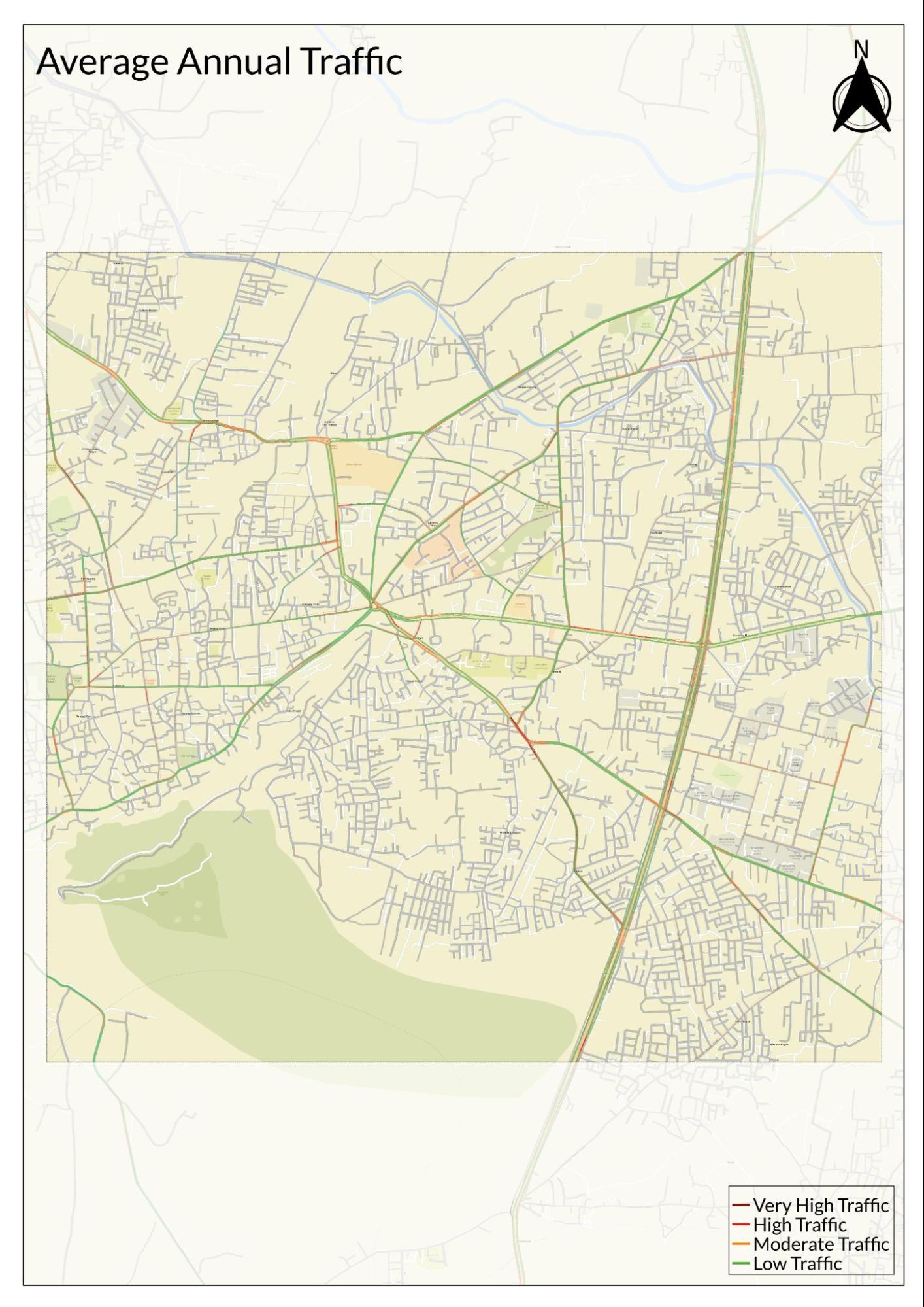
Traffic Map
Communication Networks
Newspapers & Magazines
Satara district has a long history of print media, beginning in the mid-19th century. Some of the earliest newspapers published in the district include Shubh-Suchak (1858), Maharashtra Mitra (1868), and Bodh Sudhakar (1872). These were mainly printed in Marathi, the local language, and occasionally featured content in English. They played an important role in promoting public awareness during colonial rule, offering both news and opinion pieces on contemporary issues.
Interestingly, the district also saw the early development of public reading spaces. One of the oldest such institutions is the Nagar Vachanalaya, established in 1853 in Satara city. Public reading rooms, or vachanalayas, were important in making newspapers and books available to people who could not afford subscriptions or personal libraries.
In the 20th century, newspaper readership in Satara expanded significantly. Several Marathi-language newspapers became widely available and remain popular today. These include Pudhari, Dainik Aikya, Lokmat, and Sakal.
In addition to regional news, national newspapers such as Loksatta, The Indian Express, and The Hindu are also available, especially in urban centres and educational institutions. These publications provide broader coverage of national and international news.
A number of magazines are also popular in Satara. For example, Saptahik Sakal and Lokprabha are known for their long-form articles and feature writing, while Agrowon focuses on agriculture and rural issues, a subject relevant to the largely agrarian population of the district.
Radio & Broadcasting
Radio remains an important source of information and entertainment in Satara. The district is served by Akashvani Satara, a government-run radio station launched in 1992 by All India Radio (AIR). Broadcasting on 103.10 MHz, it provides programs on local news, farming advice, music, education, and government schemes. Its reach extends beyond the city, covering nearby rural areas as well.
Interestingly, alongside AIR, Satara is home to one of Maharashtra’s most notable community radio stations. Maan Deshi Tarang Vahini, started in 2008 in Mhaswad (Maan taluka), is a grassroots radio station operated by the Maan Vikas Samajik Sanstha, a local non-profit organization. Managed primarily by women from the region, the station broadcasts on 90.4 FM and focuses on rural and women-centric issues.
The content is designed to be relatable and engaging. It includes folk songs, short plays, interviews with experts, and call-in sessions where local people ask questions about farming, health, banking, and public services. One of the station's well-known radio hosts, Kerabai, a 70-year-old woman and former farmer, uses songs and storytelling to discuss everyday problems and solutions.
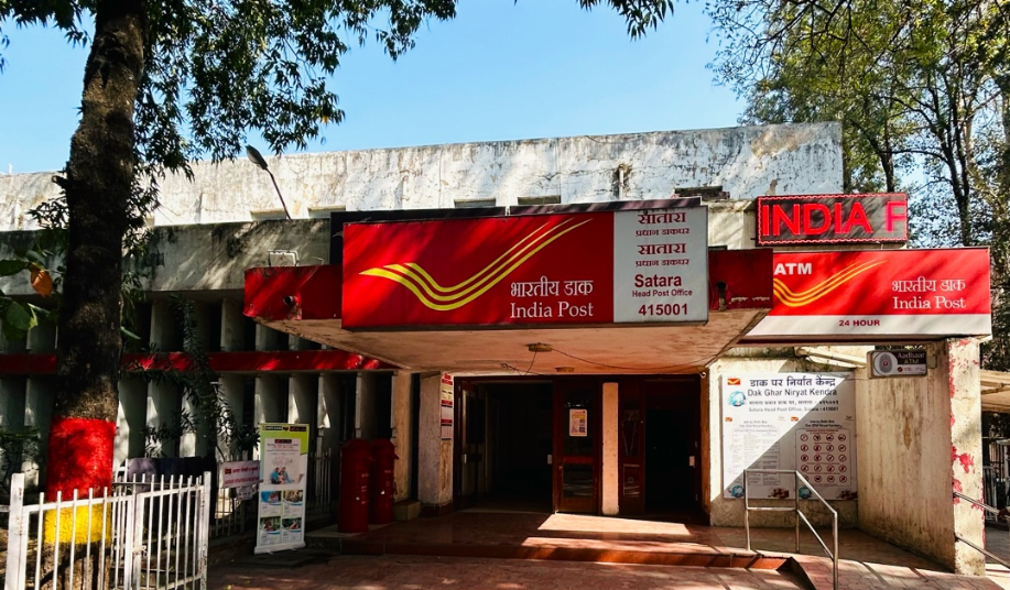
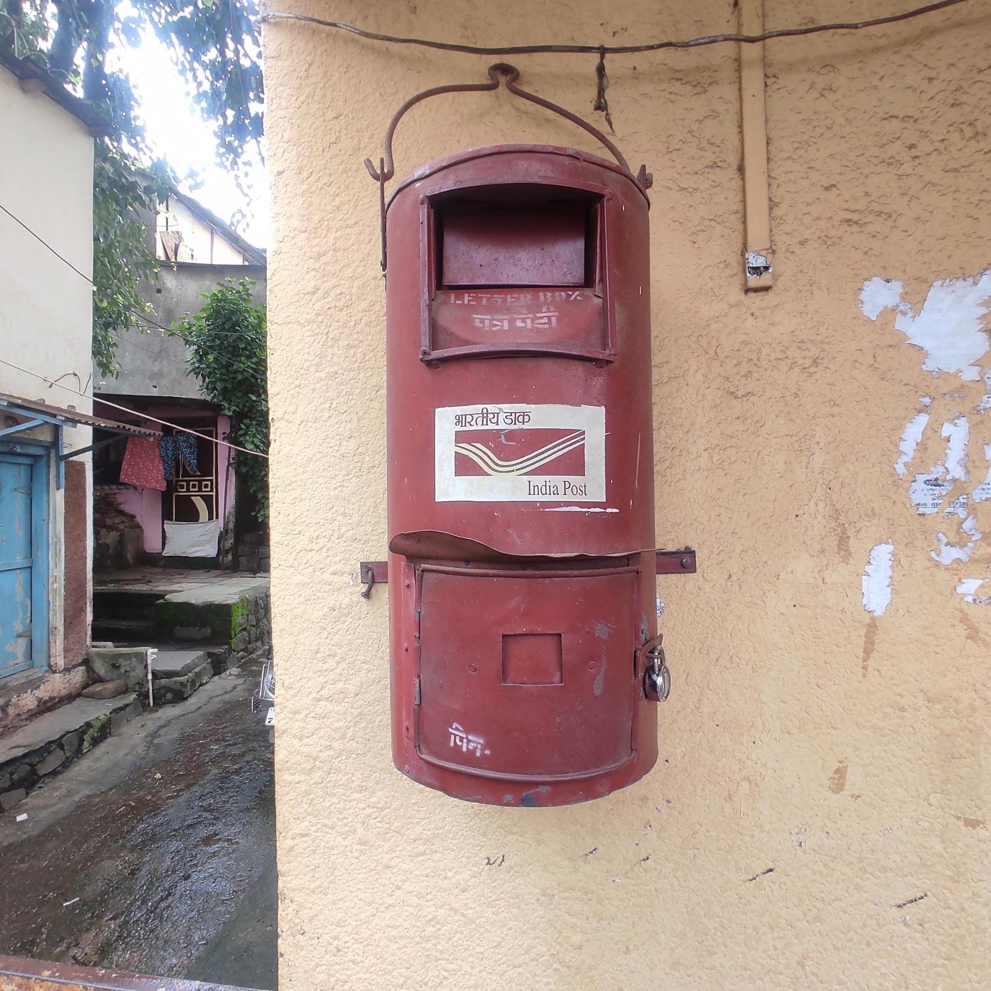
Posts & Inland Letters
The postal system in Satara also remains an essential public service, particularly in areas that are less connected by digital or private courier networks. India Post operates through a network of branch post offices and the Satara Head Post Office, handling both personal and official communication.
In rural areas, locals say that Branch Post Masters (BPMs) are often central figures, delivering letters and packages, and also helping people understand and access government-run savings schemes, such as the Senior Citizens Saving Scheme, Post Office Recurring Deposits, and Public Provident Fund accounts. These schemes are especially popular among older residents and those with limited access to private banks.
Although digital banking is on the rise, many people in rural Satara still rely on the post office for their savings and transactions, due to its reputation for reliability and its presence in even the most remote villages.
Graphs
Road Safety and Violations
Transport Infrastructure
Bus Transport
Communication and Media
Sources
Bombay Presidency. 1885 (Reprinted 1989). Gazetteer of the Bombay Presidency: Volume XIX, Satara. Gazetteer Department, Government of Maharashtra, Mumbai.
M. Bhosekar. 2022. A Newly Discovered Buddhist Cave in Wai Village of Satara District, Maharashtra. Heritage: Journal of Multidisciplinary Studies in Archaeology, vol. 8 no. 1, 777–788.
Maharashtra State Gazetteer Department. 1963. Satara District Gazetteer. Directorate of Government Printing, Stationary & Publications, Government of Maharashtra, Mumbai.
Ramadurai Charukesi. 2023. Radio Brings Its Villages Crackling to Life. Reasons to Be Cheerful.https://reasonstobecheerful.world/india-comm…
World Health Organization. 2024.Road Safety.WHO, Geneva .https://www.who.int/health-topics/road-safet…
Last updated on 6 November 2025. Help us improve the information on this page by clicking on suggest edits or writing to us.